A Philmont Story, Trail Crew 1989

In 1987, a couple of members of my Scout troop joined those from a neighboring town attending a trek at Philmont. Back then my troop prided itself with our annual "50-miler" backpacking excursions along Vermont's Long Trail. The tales of Philmont spurred my troop to send 2 crews in 1988.
The 1987 participants brought back a lesson learned that the 1988 crews heeded: Philmont's trails were easier than we were used to. The 1987 crew chose a "rugged" itinerary, the second of four difficulty levels. They loved the overall experience, but were bored with the backpacking. It was trivial by Vermont standards. The 1988 crews chose "super strenuous" - the highest difficulty level.
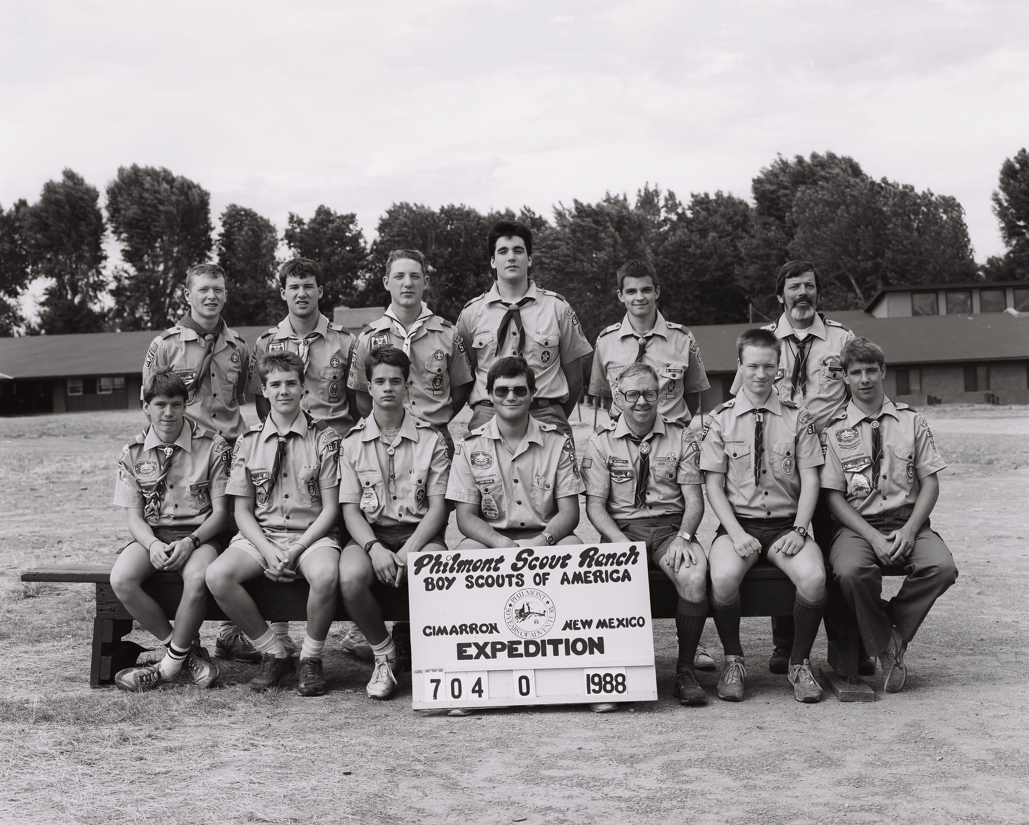
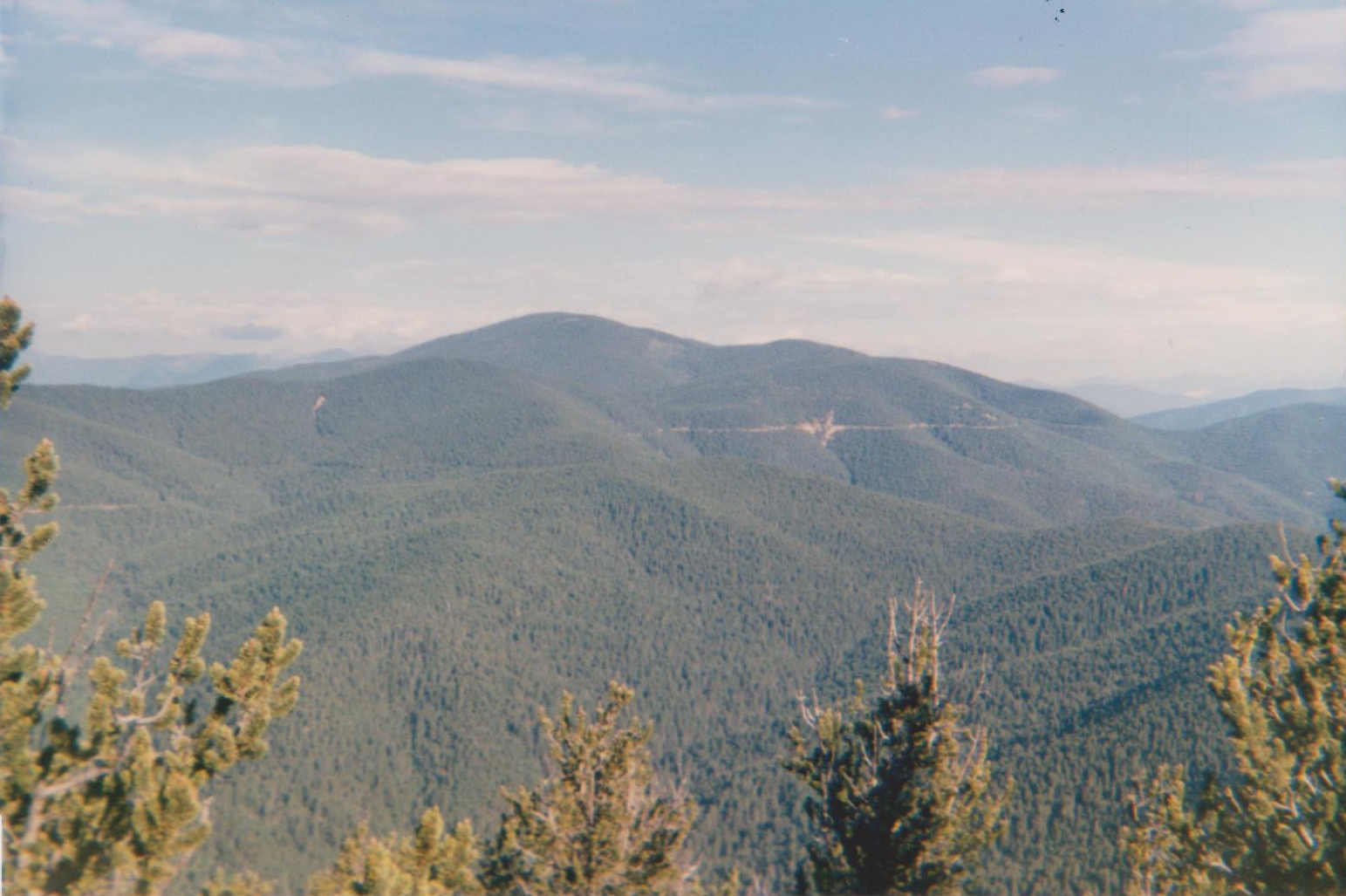
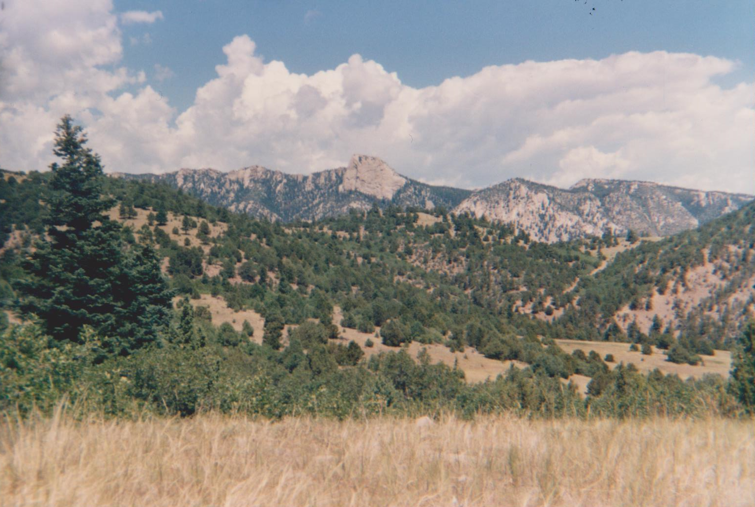
This itinerary was just right for us - the perfect balance of difficulty and program. The "super strenuous" trek profile included up and over Baldy Mountain (12,441') in full packs. Most others scaling Baldy were day hiking / only carrying day packs. It was just perfect for us.
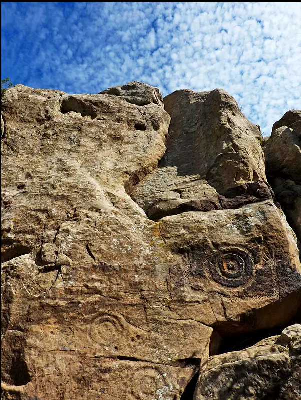
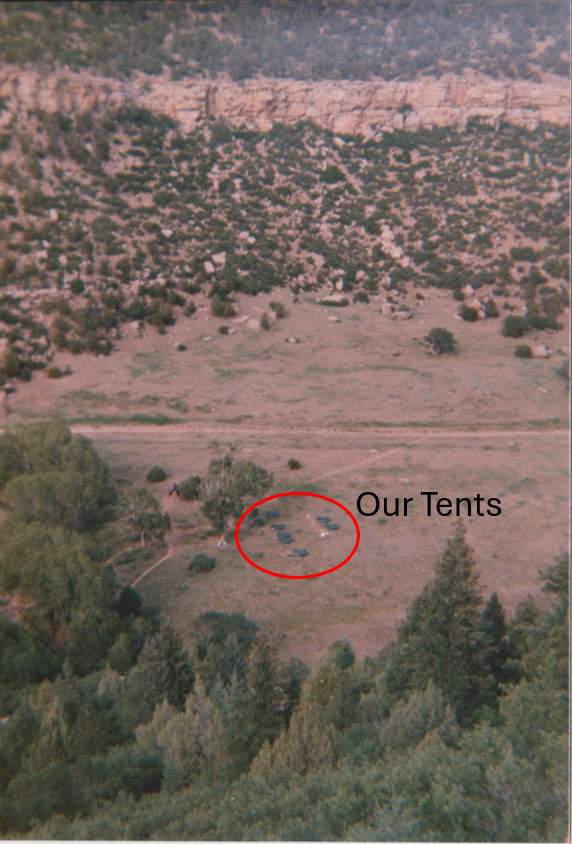
Program on the last day of that trek was at "Indian Writings" camp, which was an archeological theme. The valley was the site of an Anasazi village hundreds of years ago. The name "Indian Writings" alludes to pictographs carved onto rocks and the on canyon walls. The program activity included participating in an active archeological dig: scraping and sweeping dirt and taking notes in a gridded area. One of the members of my crew actually found something: a carved stone pipe, which ended up in the Indian Writings museum.
I had such an awesome time that trek that my father (who also attended) investigated options for me to go back the following summer. What he found blew my mind, and of course I jumped at it.
The "Trail Crew" program was completely provisional, meaning that participants went as individuals, not as part of a unit. It paired a 14-day work session with a 12-day trek. Scouts from around the country would meet up, form crews, work for 2 weeks on a project then, as payment, would get to attend a 12-day trek.
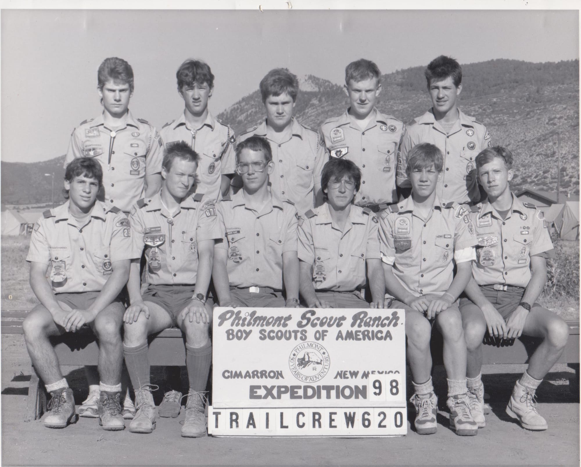
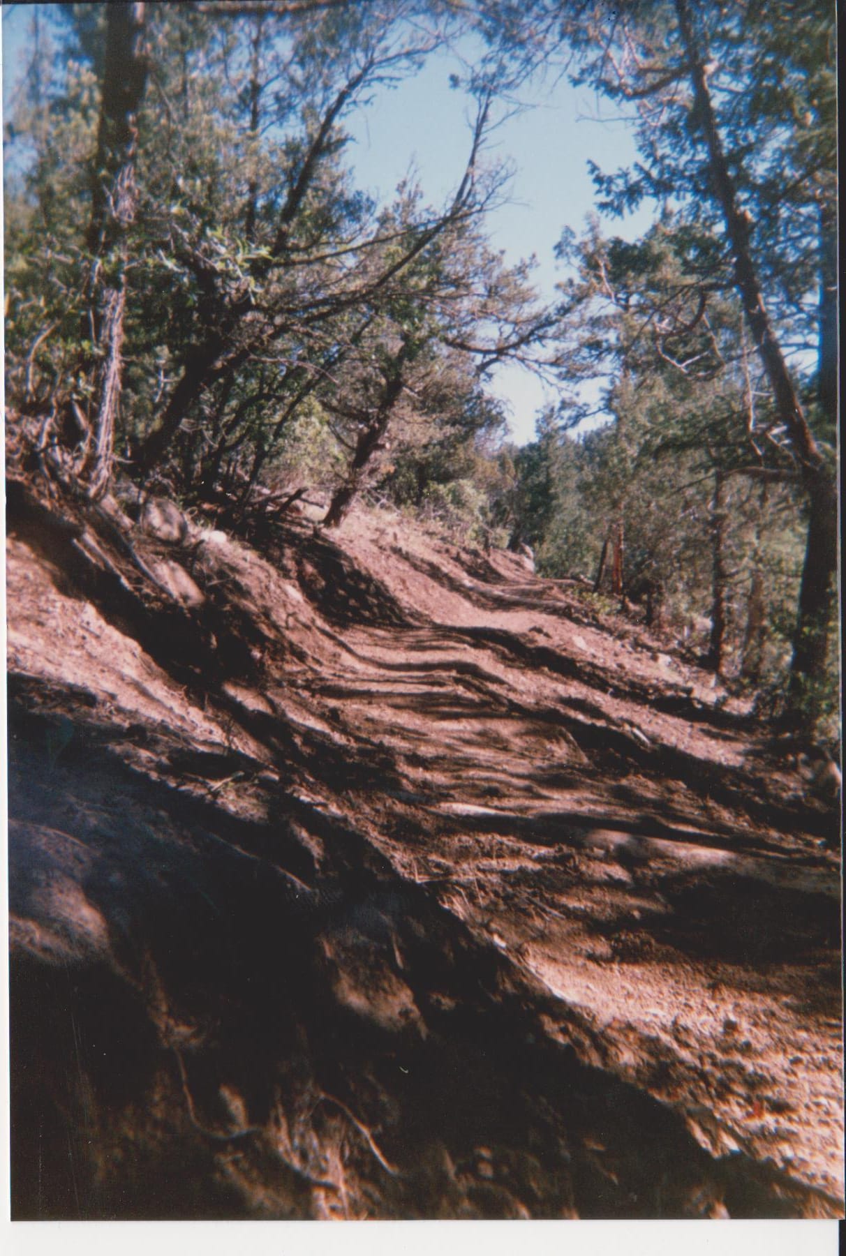
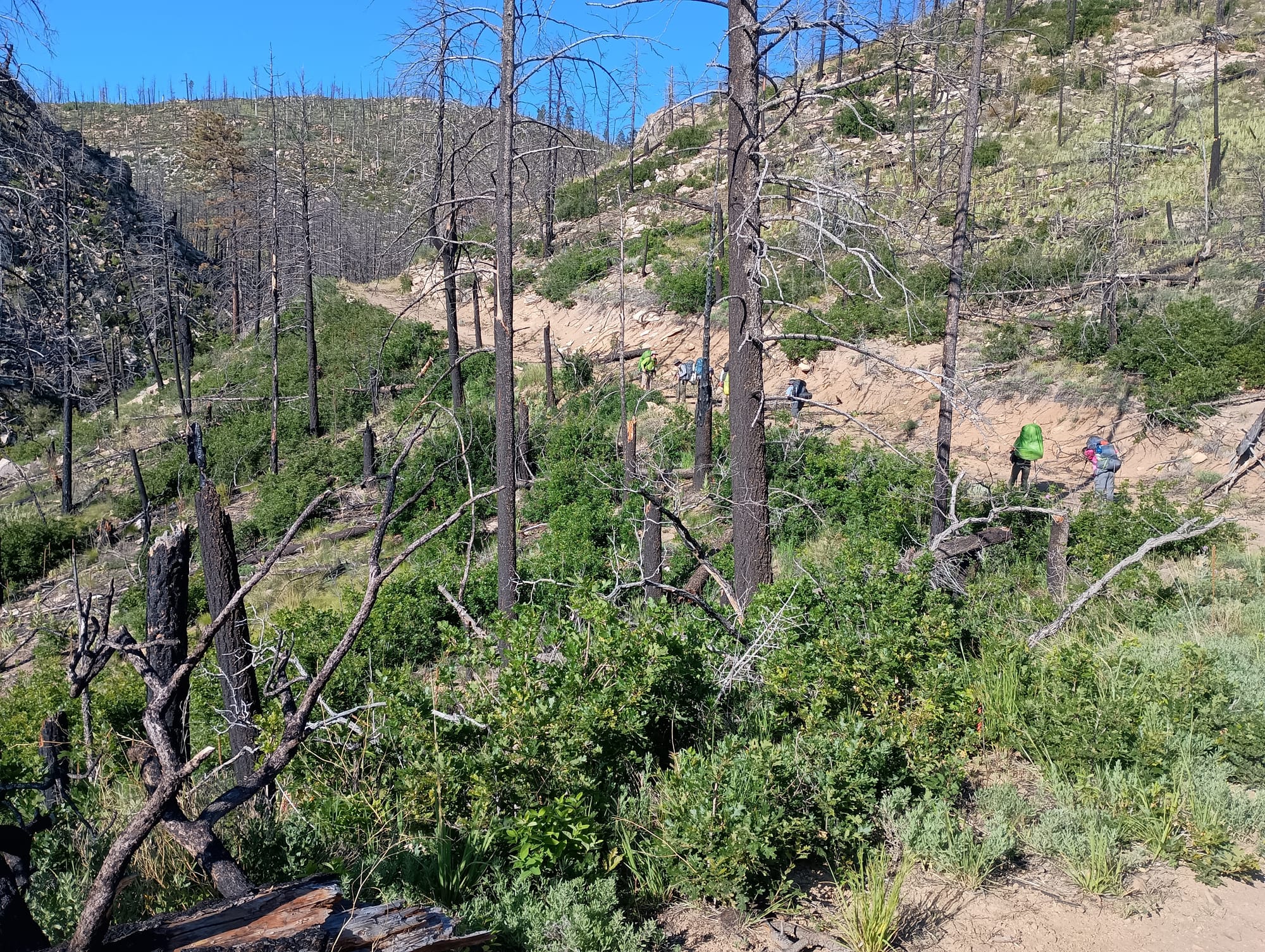
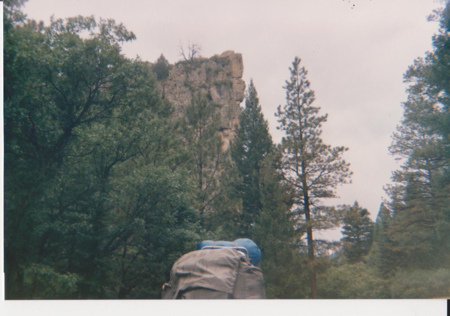
Work Site
My crew's project was building trail: from Indian Writings camp up to the summit of Hart peak.
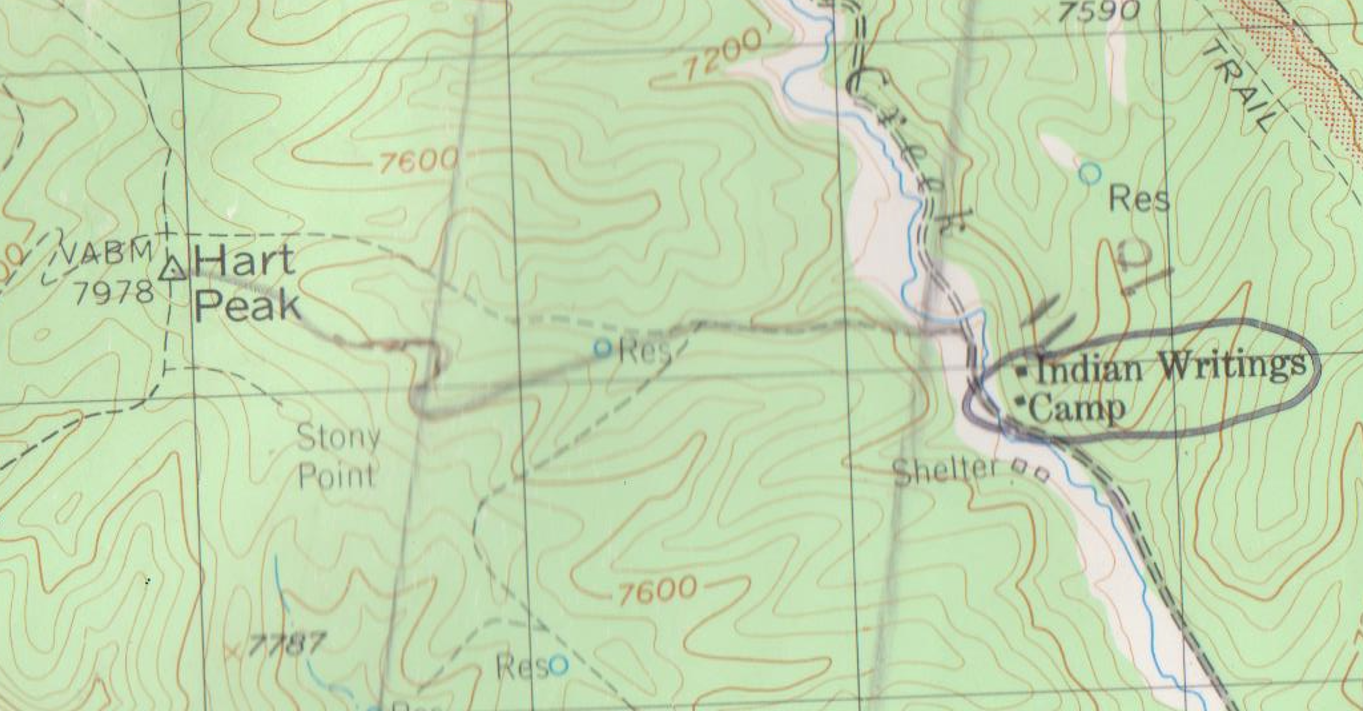
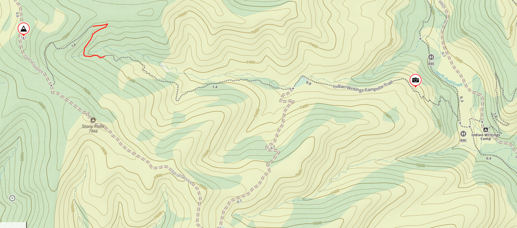
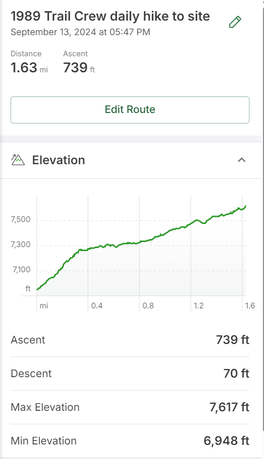
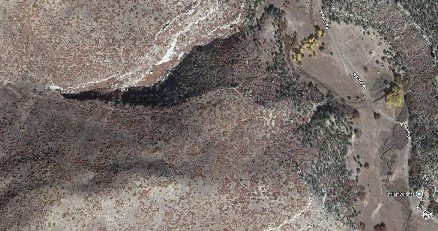
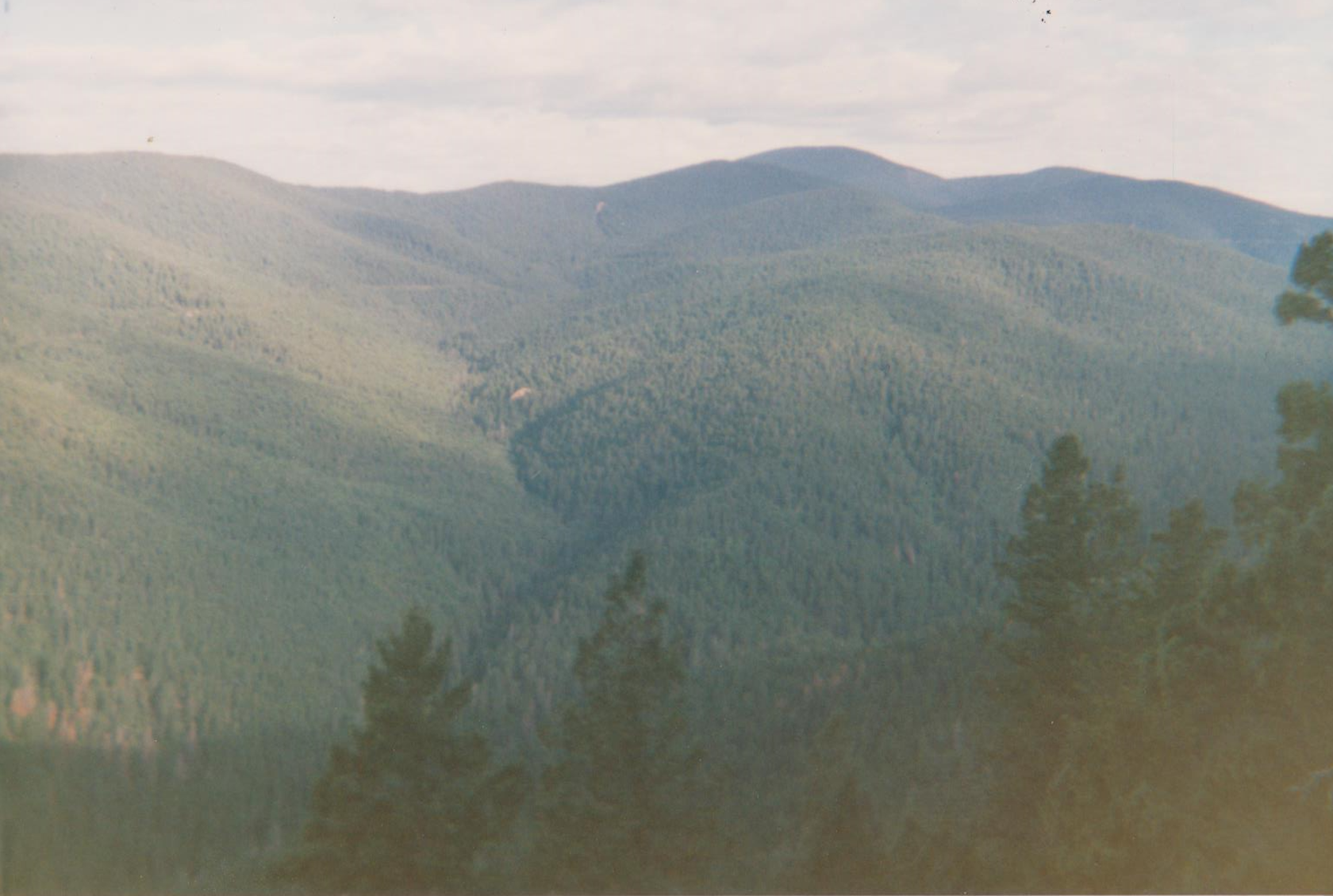
According to GaiaGPS, we built just over 1/4 mile of trail in that 2 weeks. And it was a 1.63 mile walk, up 740 foot of elevation gain, every morning. I remember that daily hike well, carrying water and tools up to the site. I remember the pond shown on these maps. I remember the steep escarpment with switchbacks. I remember the big ravine/switchback about a quarter mile from our worksite. I remember an enormous rock, the size of a car, that took the entire crew with giant levers to move. We made the levers from trees. I remember watching them bend and snap. (Sadly, I wish I had taken a picture of that rock.)
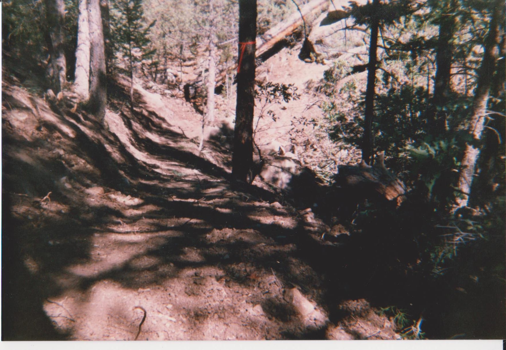
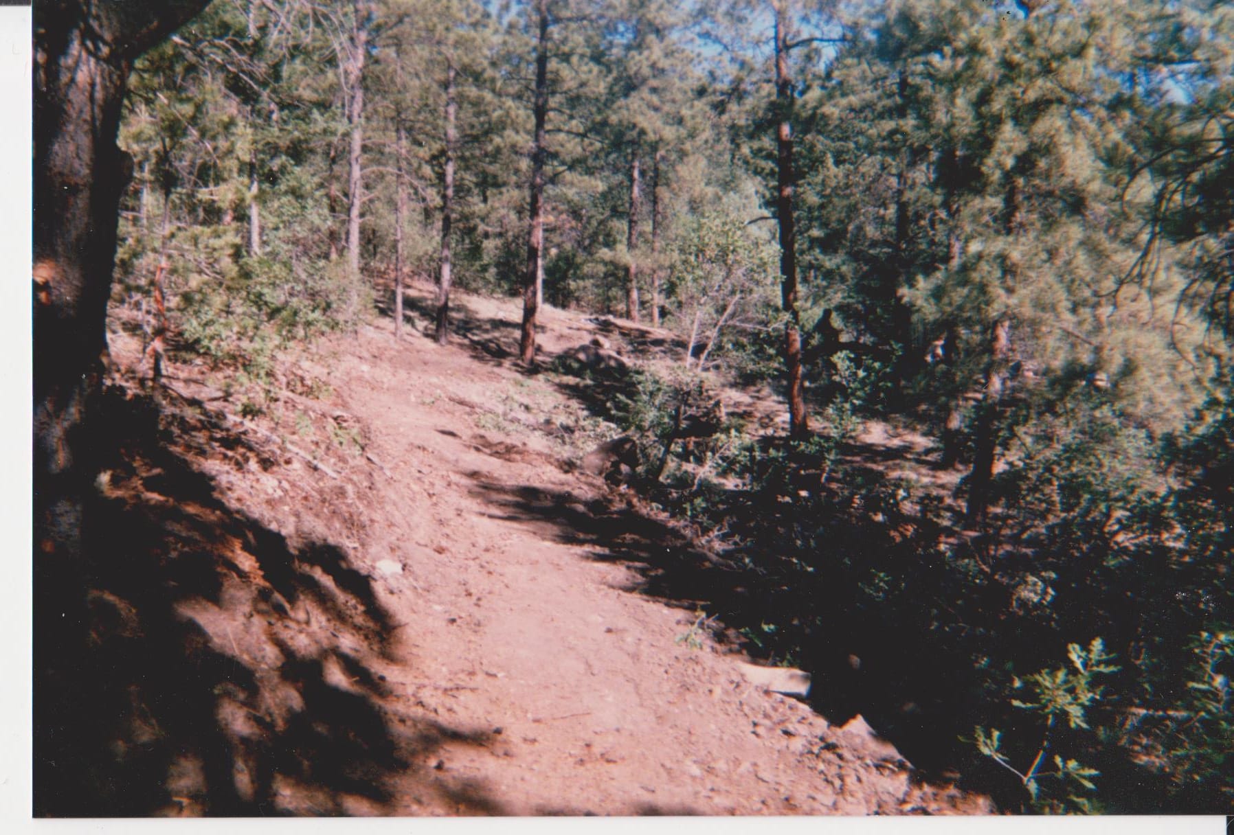
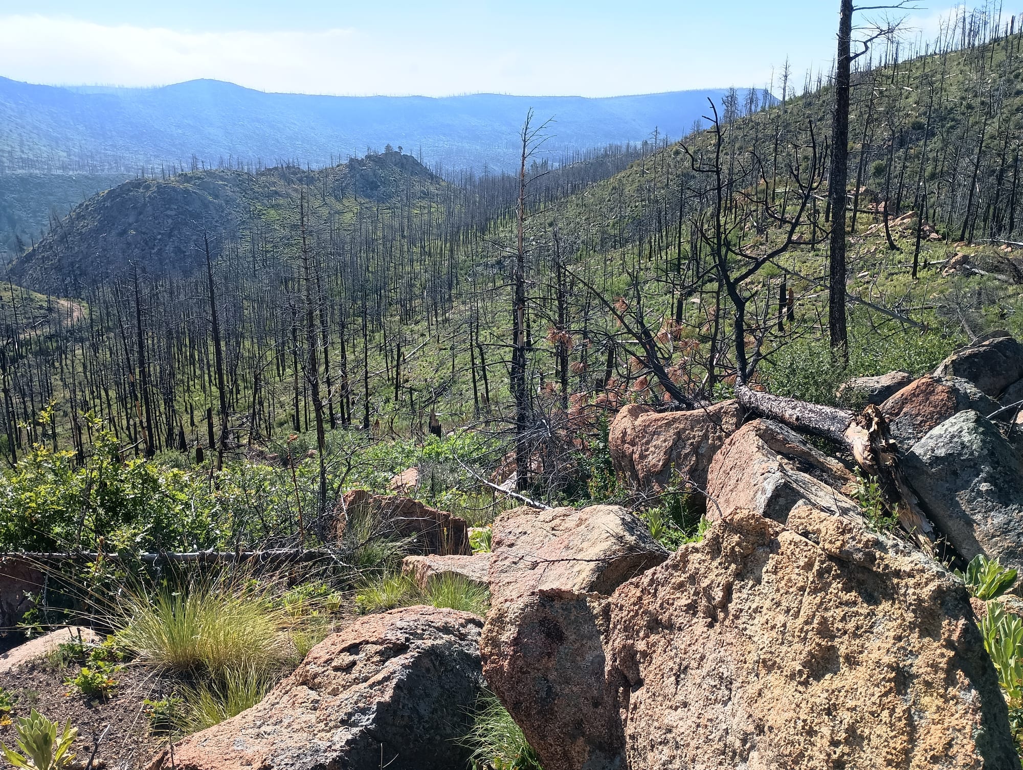
Work site as it appears today.
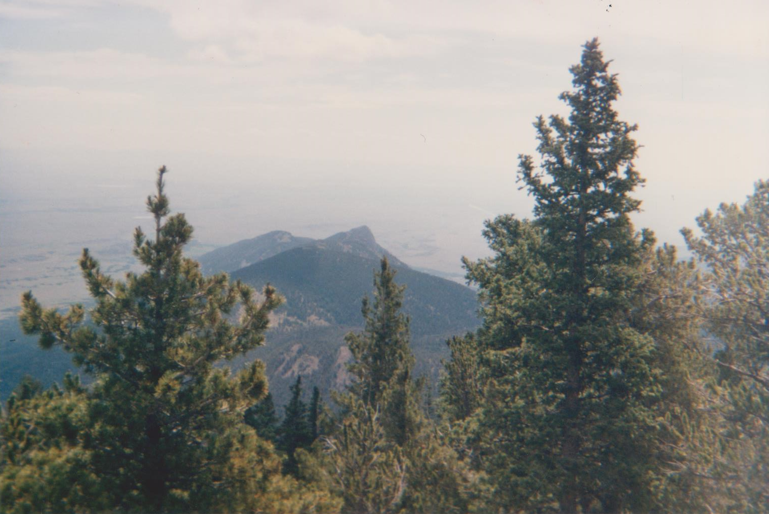
I looked at aerial photos to locate the trail we built only to find that it looks nothing like I remember. The whole canyon burned in the 2002 Ponil complex fire.
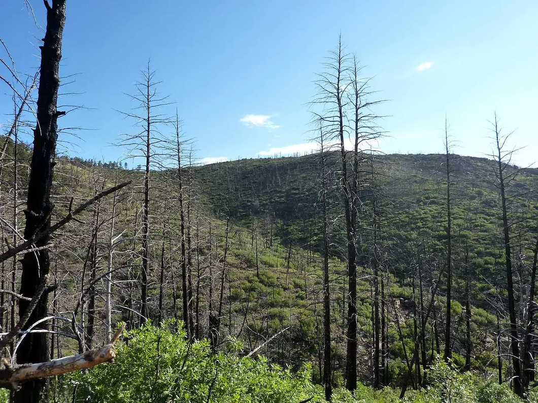
Unfortunately fires are "normal" and "common" in this part of the west. There have been at least 3 major fires in Philmont since I was there in 1989, the most famous of which was the "Ute Park" fire in 2018. I passed through the Ute Park burn zone on my 2023 trek. Its a bizzare and sad wasteland. Nothing looks like it did. It's eerie.
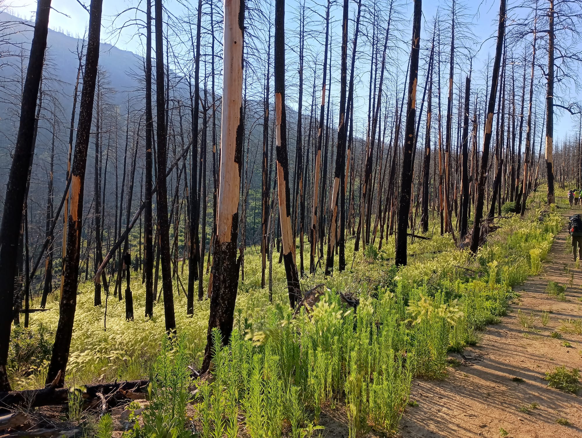
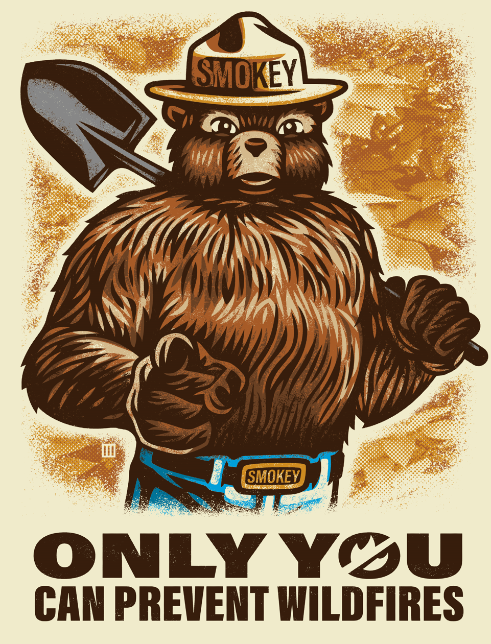
Ok, enough with the depressing post-fire wasteland pics. Remember boys and girls, only you can prevent forest fires!
1989 Trek
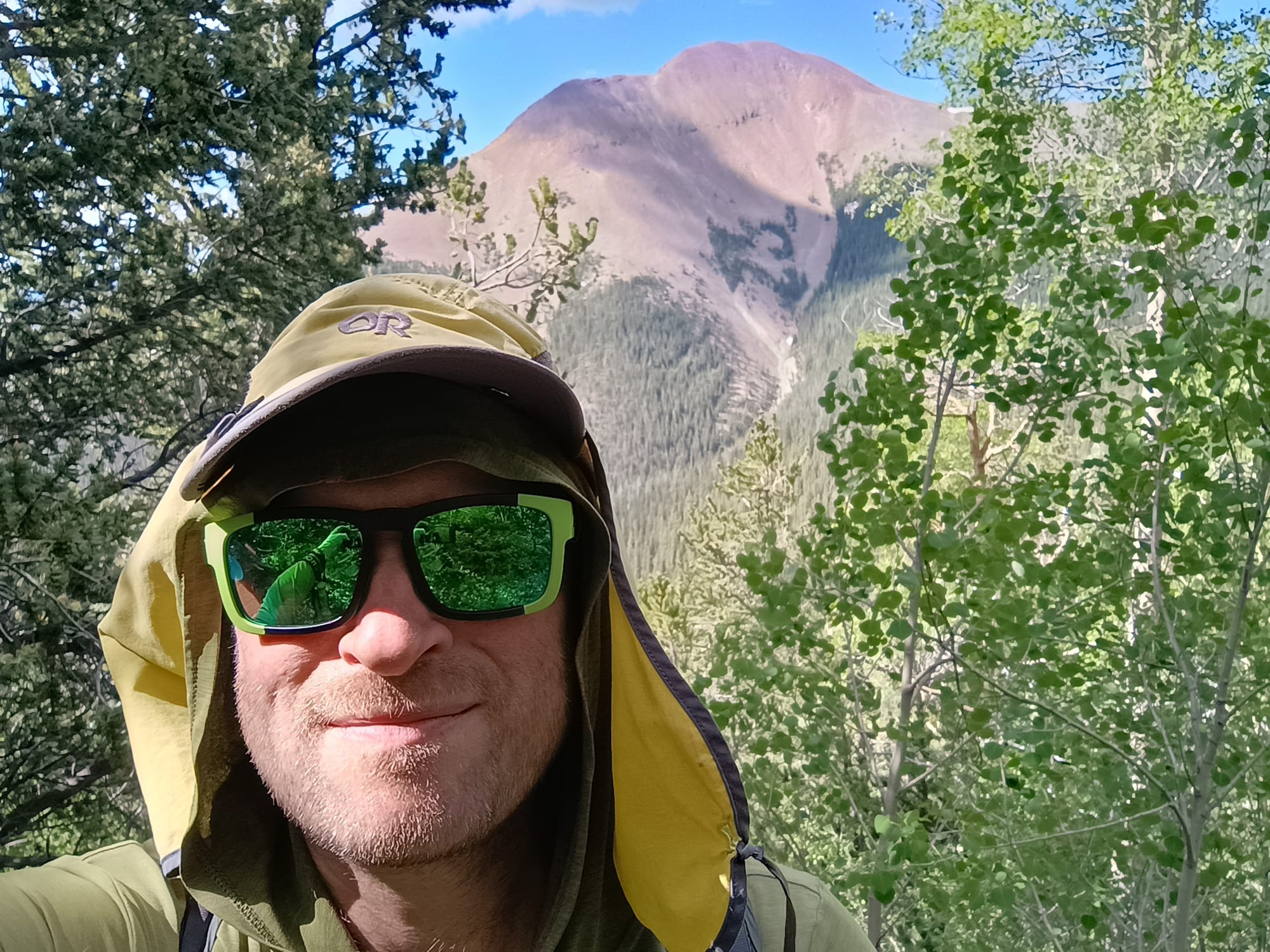
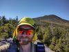
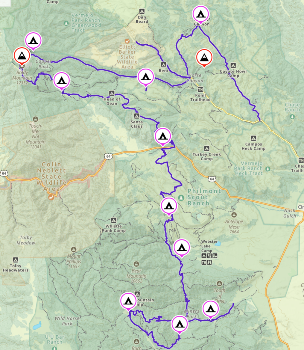
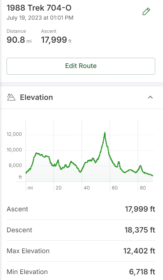
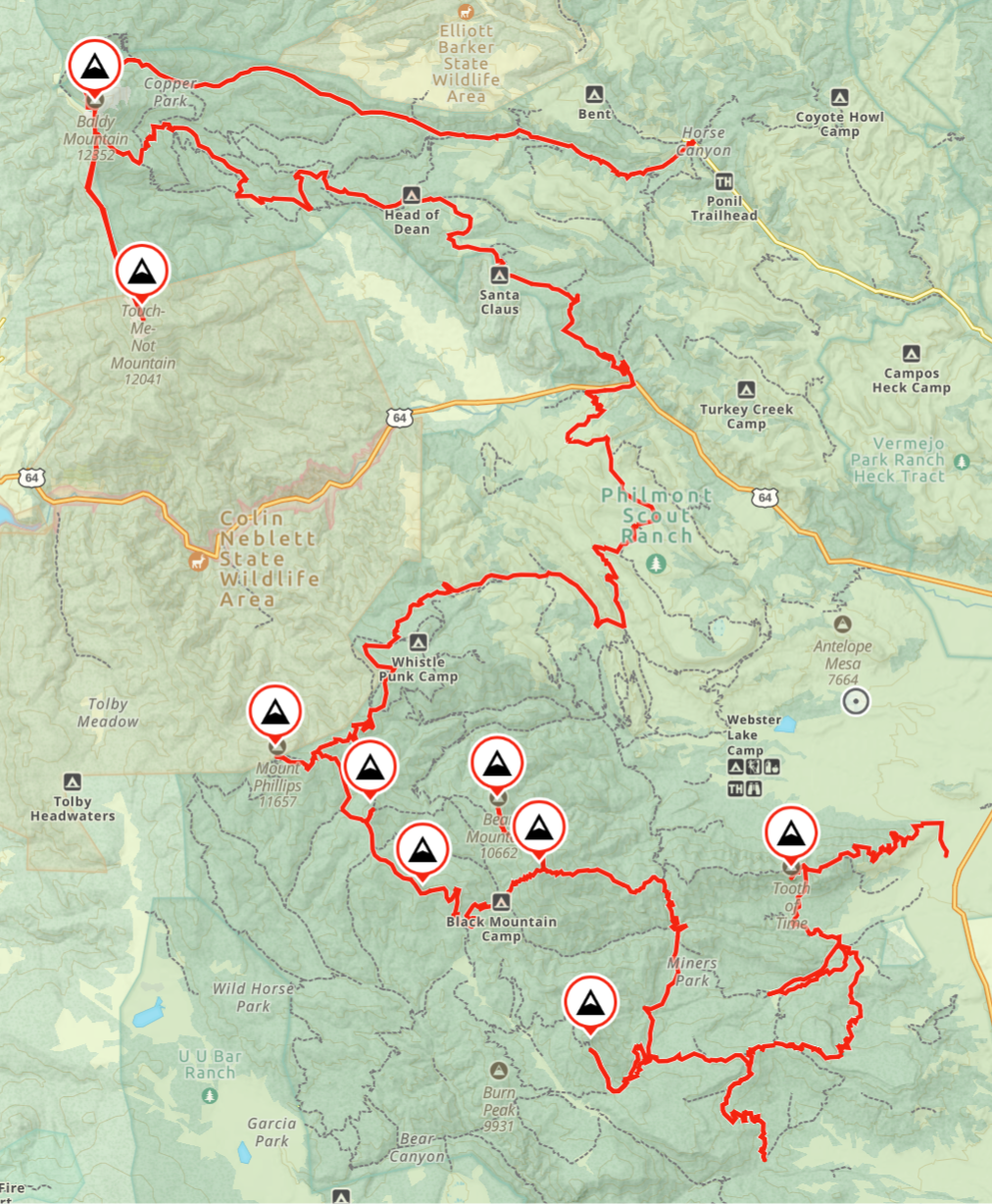
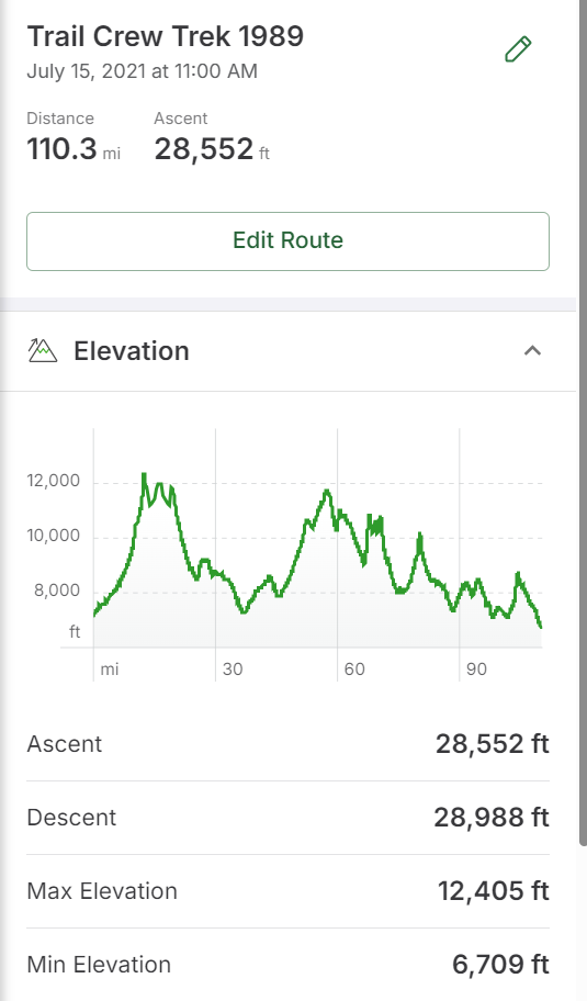
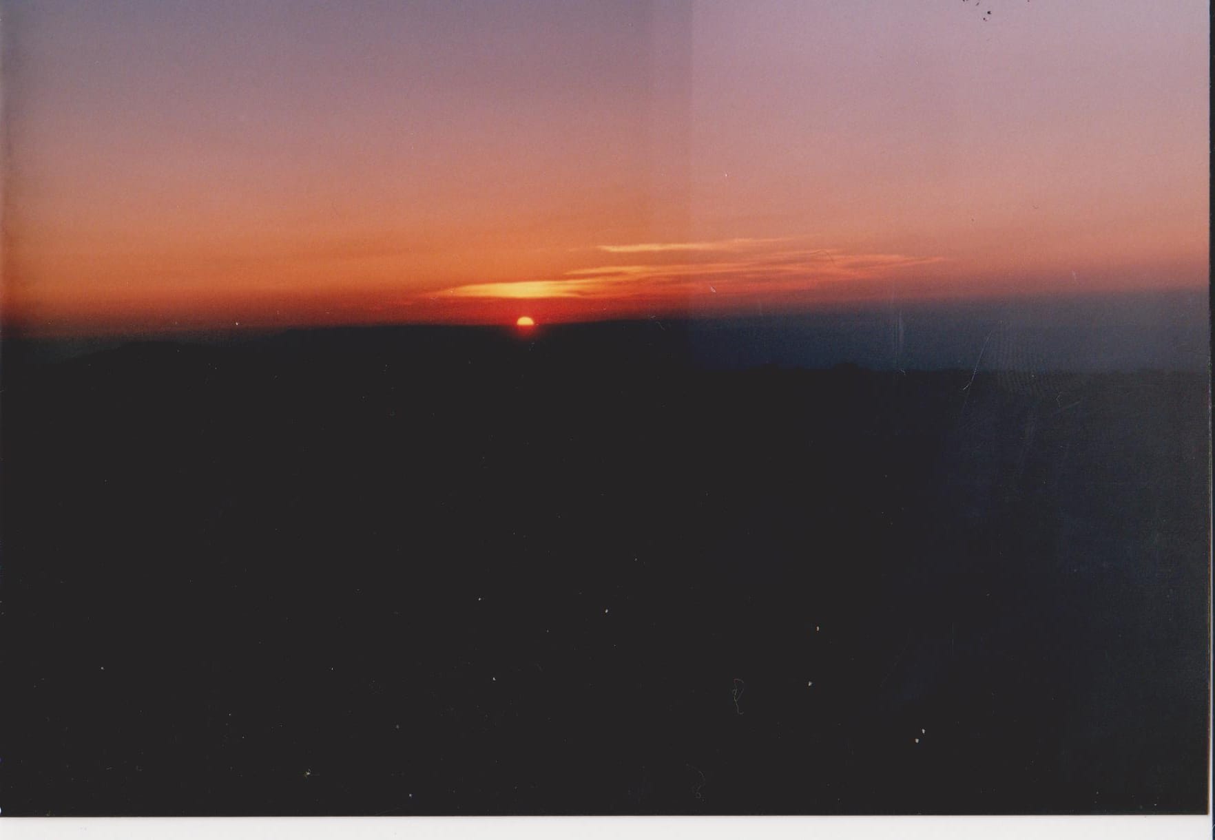
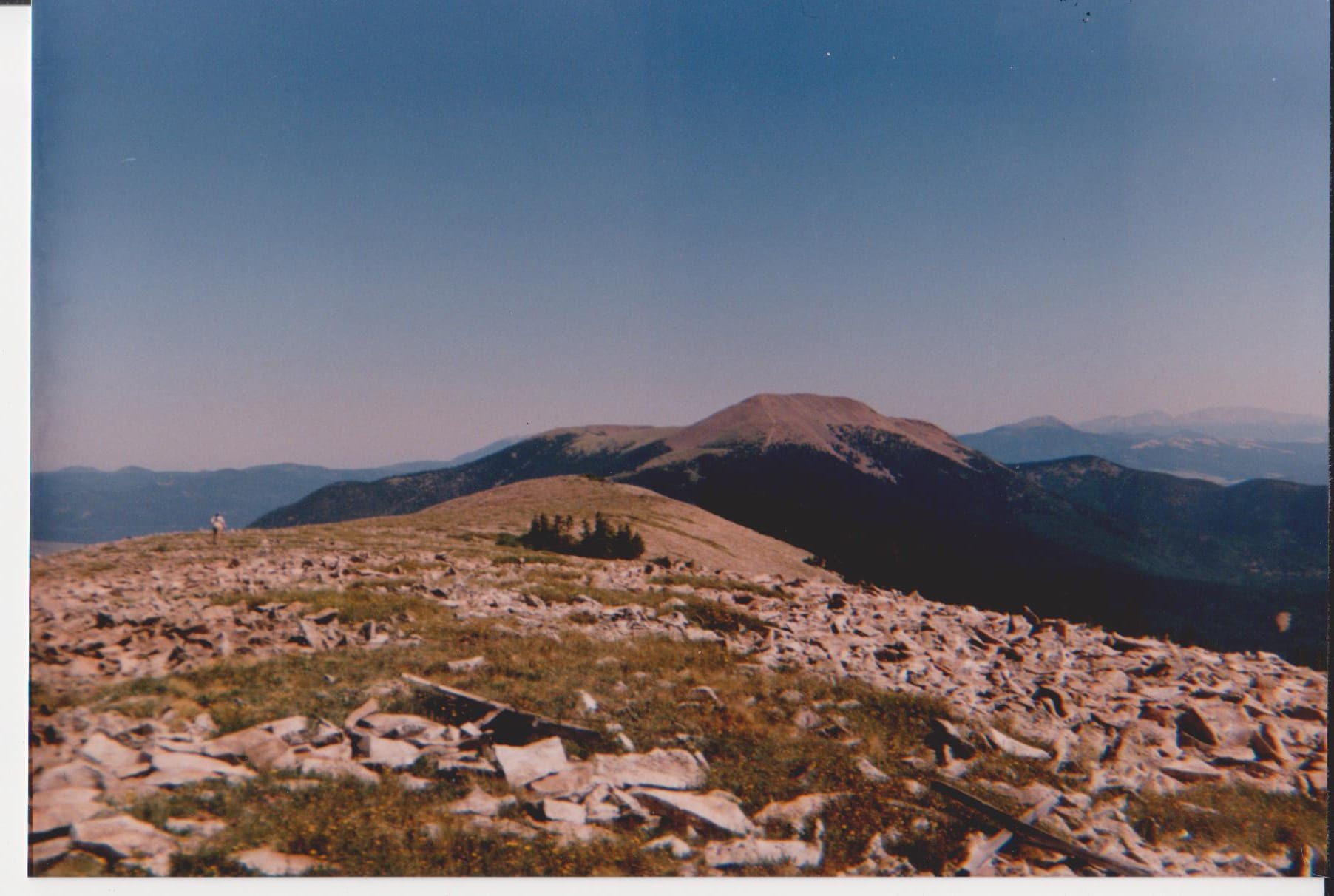
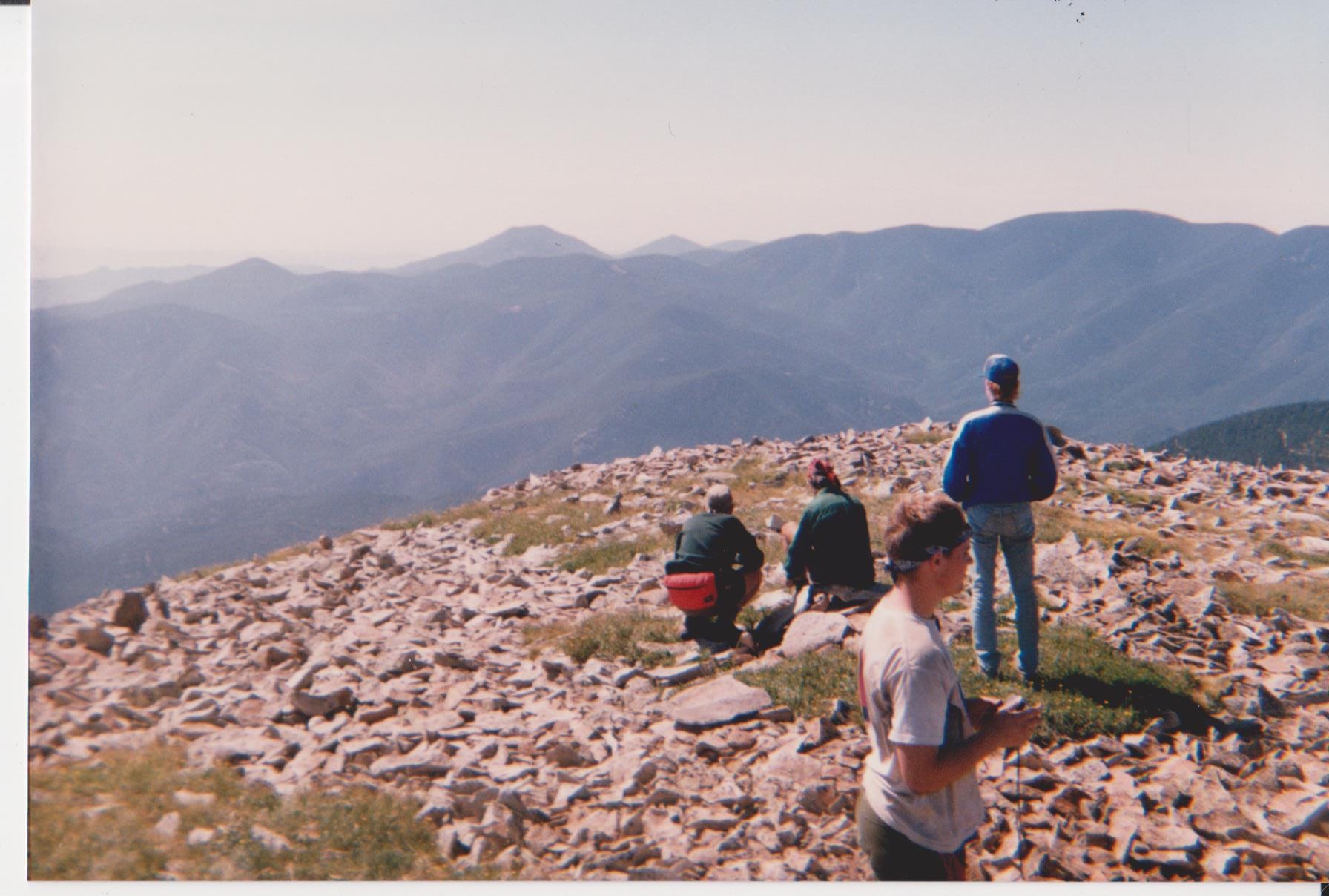
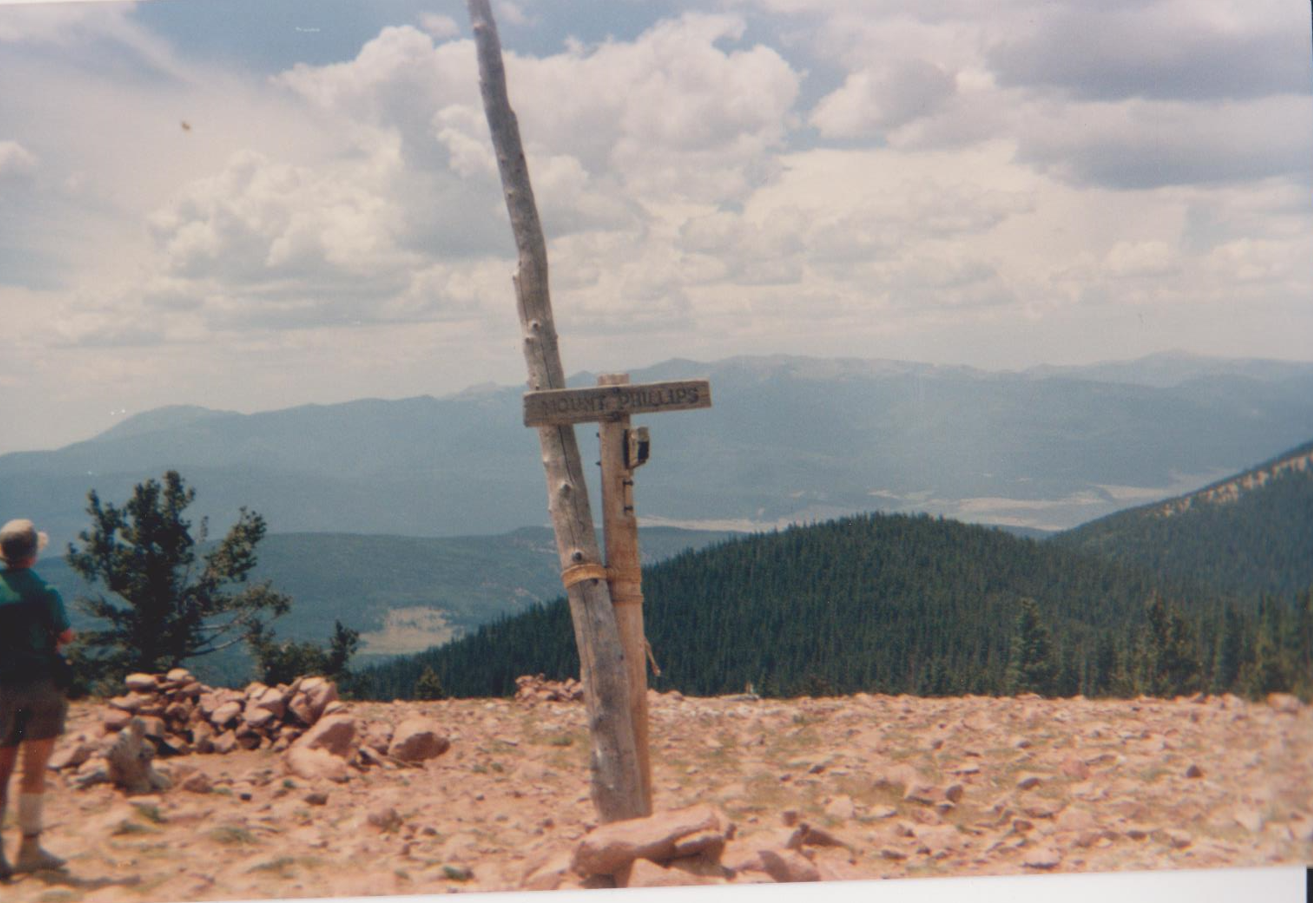
This provisional crew - 16 and 17 year olds - Life and Eagle Scouts all - had just done 2-weeks of hard labor at altitude. We were studs, fully acclimated, and ready to go. And we were almost staff. (We weren't, but, I mean, Philmont gave us lots of leeway.) When it came time for our trek, they let us do whatever we wanted. We custom-designed our itinerary to go everywhere. We wanted to hike. We picked out the biggest and badest mountains Philmont had to offer. We mapped out a course to hit them all. Baldy Mountain. Mount Phillips. Bear Mountain. Black Mountain. Big Red. Bonita Peak. Commanche Peak. Trail peak. Tooth of Time. Hiking Tooth Ridge back into base camp. We even slept on the summit of Baldy Mountain - something nobody does - then bushwhacked off-reservation to hit Touch-Me-Not. 110 miles and 28,500 foot of climb. Boo-yah!
Did I mention I was voted crew leader?
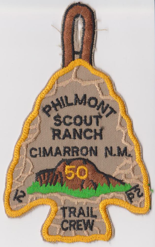
The Prize
There are not many of these around - a 50th anniversary Trail Crew arrowhead award patch. The gold border (50th anniversary) was only given out in 1988 and 1989. I'm not sure how many trail crew sessions there were each year. I know by counting heads in the mass-group photo that there were 75 in my session. So maybe 300 of these exist in total? Anyway, it is the most exclusive bit of bling I own, and my most cherished. I posted a picture of it on a Philmont group chat some time back, and it was recognized by one of the members of that year. (His crew built a cabin in their 2-weeks.) Another commented how this was "back in the day" when trail crew was the full 26 days. Another commented that this is a "righteous" patch. Indeed.
Denouement
Wood Badge is an adult training program where participants are put in patrols of people they've never met to live and work together on training and challenges. It's a learn-by-doing program that goes through the stages of team development: forming, storming, norming and performing. I only knew one Wood Badger as a youth, and I looked up to him mightily. I had always wanted to go to Wood Badge. I jumped at the chance to attend in 2019. I had so much fun. It was like reliving my youth. It wasn't until later that I understood why so much of Wood Badge felt second nature to me. I lived the stages of team development those 26 days in 1989. That month shaped my views on a great many things.
Keep Hiking My Friends