The Hardest Day
In November of 2022, on the Lone Star Trail (LST) north of Houston, I assisted a crew of Boy Scouts from San Antonio on a beginner-level backpacking "50-miler." Most on the crew were strong, older scouts who had done some 1-2 day backpacking trips before, but never a multi-day trip of more than 20-25 miles. As a beginner trail, the LST is ideal. It's "plush" as Tina would say. There was rain in the forecast, and we were all prepared, so nobody was surprised mid-morning on the second day when it started to rain. It was one of those constant all-day soaking rains that ebbed and flowed, but never let up. The temperatures dropped throughout the day. I don't care who you are - 45 degrees and soaking rain is just downright miserable. When the crew made it to the campsite that evening we were chilled. More than one bagged out of it right then and there and went home. Those that remained got a heavy dose of type 2 fun. Around dinner that evening - after the rain had finally stopped - I commended the spirits and fortitude of those that stuck it out. I made a passing comment to one Scout about how that day was almost certainly the most miserable day of hiking in my entire life. I heard later that my comment had impact. A badge of honor for the Scouts - that they had survived the worst hiking Mr. Keenan had ever experienced. True word fame amongst boys.
I attended Philmont this summer with many of those same Scouts. At the end of that trek's hardest day one of the Scouts with me on that miserable November day asked me what my hardest day of hiking had ever been? That day we had just finished a 3,800 foot climb to the top of 12,441 foot high Mount Baldy, then the descent of the same. As a crew we faced some adversity on this round-trip: some from miscommunication, the rest due to physical abilities of various crew members. Regardless, we had arrived back at our campsite somewhat dejected. The adversities we faced resulted in delays which resulted in missed opportunities: there were anticipated "program" items that the crew missed out on. Additionally, the crew was forced to confront the question: was this itinerary too difficult for us? Against this backdrop, the Scout asked me what was the hardest hike I'd ever been on?
I sat there thinking. What was the hardest hike I'd ever been on? And what constitutes hard? Logically it would have to be something I struggled or failed to complete. But I had never failed to complete a hike. Some were more strenuous than others, but I had never quit any of them. I have been with groups that have had trouble, but I have never been the limiting factor. Whatever my "hardest" was, therefore, would probably have to be something I was solo on. I've had a few of these trips (BBNP, GMNP, various day hikes, etc.) but I'd never had any problems with any of them.
But I did have one trip on the horizon. "Ask me again at the end of September" I responded.
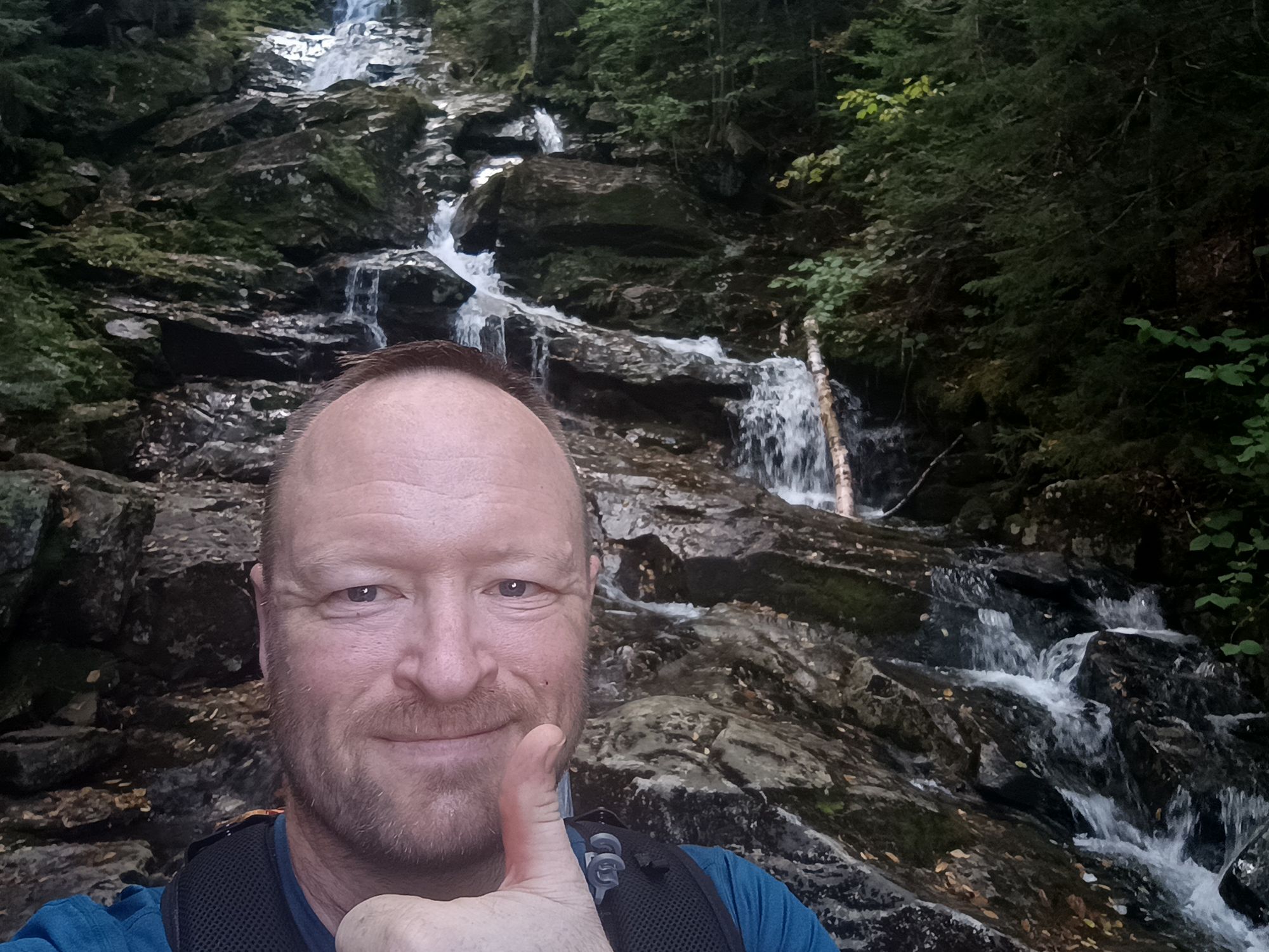
I had an 8-day trip scheduled 9/2 thru 9/10 where I planned to push myself a bit. I was going to be solo for the majority of the trip, and it was on terrain that I felt I knew, even though I'd never done that exact trail before. I grew up in Vermont, and Vermont's Long Trail is where I cut my teeth backpacking. I rate everything in comparison to what I know/remember from the Long Trail. When I was looking for a place to spend a week of vacation time in 2023, there were logistical or medical issues that prevented me from either my first or second choices. My third choice offered pragmatic logistics as well as nostalgia. I chose to start where the Long Trail (LT) and Appalachian Trail (AT) parted ways just north of Sherburne Pass in Vermont and head east on the AT. I remember passing this junction in my youth and had always wanted to do that last section of the state.
I have heard it said that the LT is essentially a mini AT. In 2021 I picked out some of the most difficult sections of the LT for a series of day hikes. I loved it. They were challenging, but no a problem at all. So when I planned this year's AT trip, I compared my daily itineraries to that series of day hikes from 2021. On paper, this year's AT trip difficulty looked much like the 2021 day hikes back-to-back-to-back. Perfect I thought. In aggregate it might be the toughest trip I'd ever done, but it all seemed plausible.
For comparison, here is the list of day hikes I did in 2021:
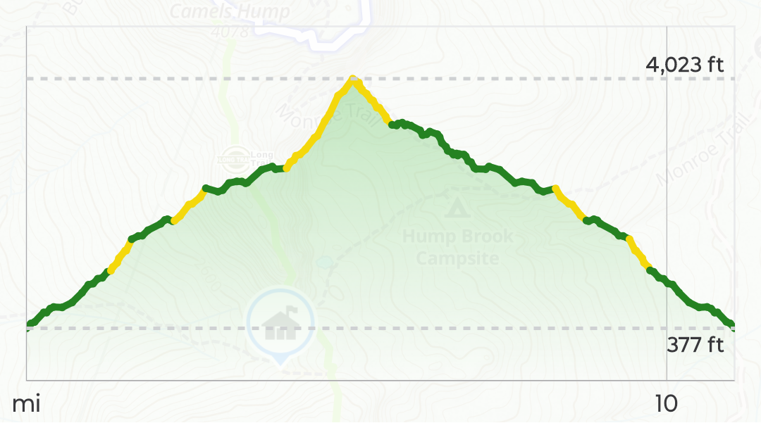
9/19/2021 Camel's Hump from Bolton: 12.4 miles, 4,080 foot of ascent and descent along some exceedingly steep trails. 9.5 hours round trip.
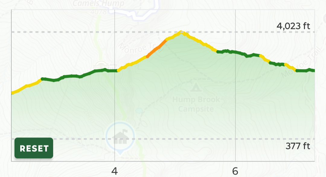
9/21/2021 Sterling Range from Johnson: 13.7 miles, 4,566 foot of ascent, 3523' of descent, with some really steep trails, including an exceptionally steep climb. 9.25 hours.
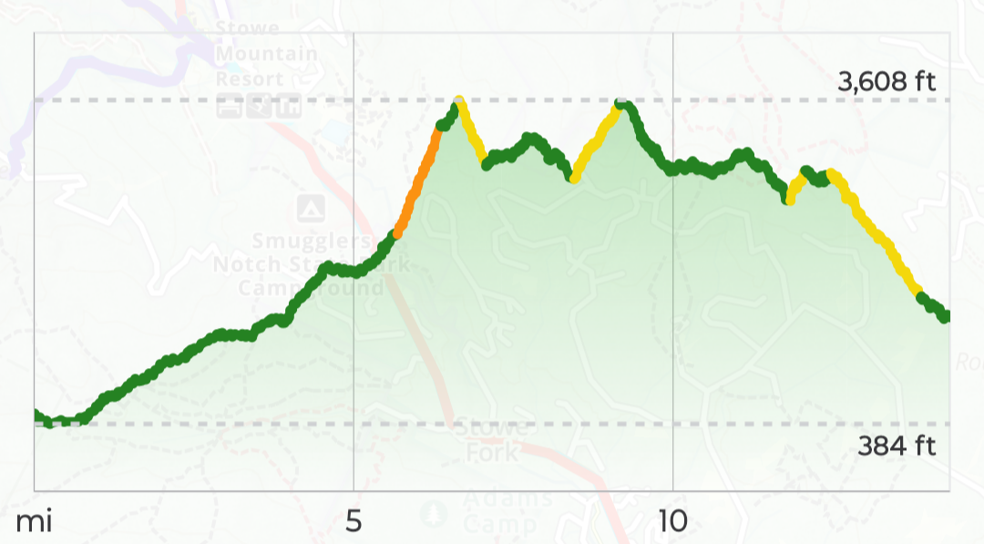
9/22/2021 Mount Mansfield loop from Stowe: 8.4 miles, 3,500' of ascent, 3,500' of descent, 7.75 hours.
9/23/2021 Sterling Pond loop from Smuggler's Notch (with Tina.): 2.5 miles, 976' ascent/descent. 2 hours.
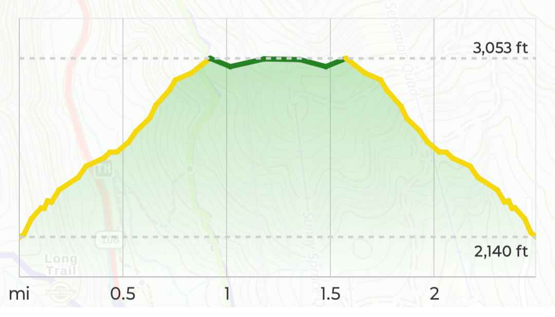
Yellow and orange on these elevation profiles indicate steep and exceptionally steep stretches (or "fun" and "more fun" as I preferred to think of them.) Traditionally, I have always considered 10-12 miles on the LT a "full" day, and 15 miles a "long" day. (20 miles in a day on the LT - at least north of Govenor Clement Shelter - is just nuts.) When planning the AT trip, I assumed I could get away with the "long" day average of 15 miles without much trouble - especially since I'd be carrying an Ultralight pack (max weight 16 pounds) and would be traveling at my own pace. With that in mind, I laid out this itinerary:
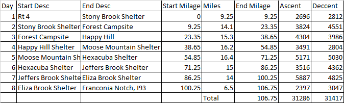
So, yeah, this would be a stretch, and it would push me, but it should be doable. When I answered that Scout, I was confident, but I also knew what was in store: Four days with more elevation gain than we had done that day at Philmont (3,800'), with two over 5,000' of gain, and one nearly 6,000'.
Because this itinerary was aggressive, I planned out a series of "bail out" points in case I'd bitten off more than I can chew. Additionally, "tough" days were followed by less strenuous days: The 4,304' day 3 was followed by the 3,491' day 4. The 5,171' day 5 was followed by the 3,516' day 6, and the monstrous 5,887' day 7 was followed by the 2,397' day 8.
Best laid plans.
So what happened? Why am I writing this? Even though I had pre-planned bail out points, my plans did not comprehend or provide contingencies for a couple things: (1) the temperatures, (2) the dew points, (3) the ruggedness of the trails, (4) changes in plans, (5) loss of equipment, (6) steepness beyond anything I'd ever experienced, (7) chafing, (8) the lack of a bail-out option on day 8, and (9) poor cell phone coverage, even on top of mountains.
The weather
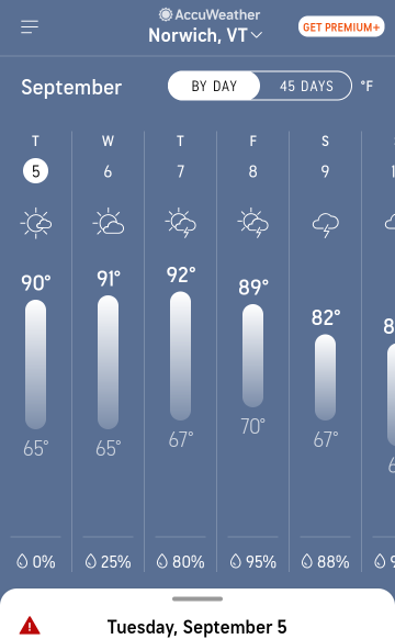
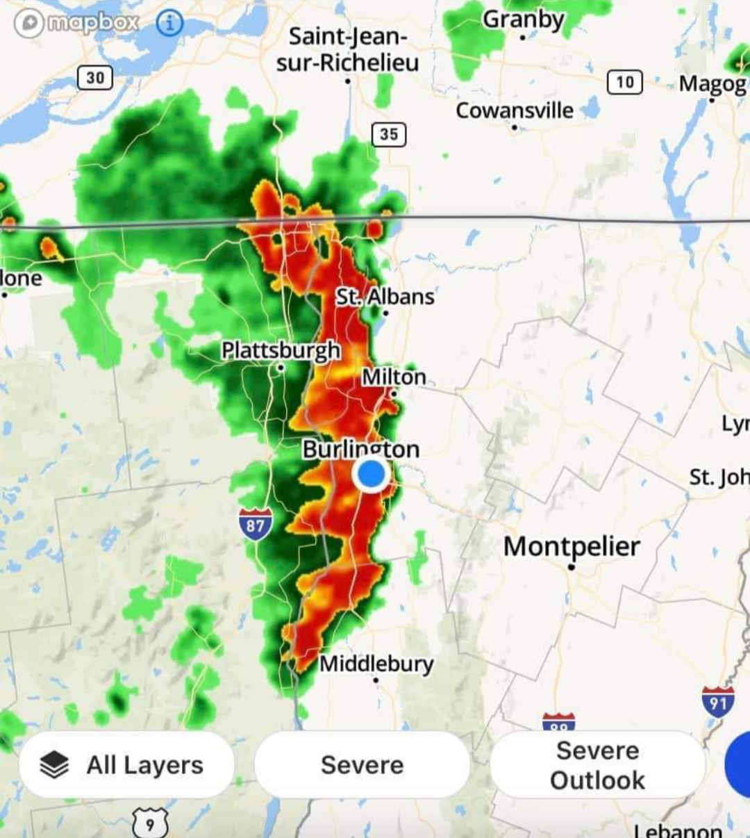
The summer of 2023 was record-breaking for Vermont and the Northeast in terms of rain. Vermont had horrendous rains in July, including some flooding that washed roads away and swamped entire towns. Parts of the AT/LT in southern Vermont were so bad the Green Mountain Club had to advise people stay away, and at least one AT thru hiker ("Steady Eddie") died when he was swept away trying to cross a raging brook. I fully expected a September trip to be a slog. I suspected rain/mud might cause me to bail. But remarkably as my trip date approached, a magical break in the rain coincided with my week, and the trail dried up. What replaced it, however, was just as unpleasant: high temperatures and dewpoints. According to the weather predictions for Hanover/Norwich, daily highs got up to high 80s/low 90s on several successive days.
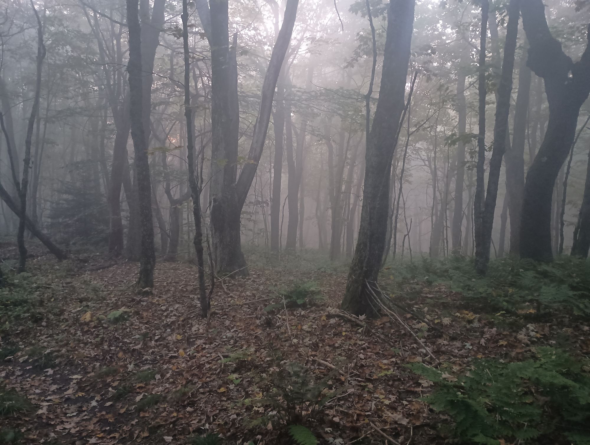
While the shade of the woods kept the air temperatures significantly lower (like 80-82), the dewpoints exceeded 70 for several days in a row. One morning I was walking in fog at 76 degrees! This picture is not rain - this is the fog! It was so heavy that it was actually dripping on my head from tree branches as I walked by.
The result of all of this humidity was that I was an unending torrent of sweat. One of the things that I did prior to this trip was scrutinize every gram in my quest for a "UL" experience. As a result, I had chosen to give up carrying my tried-and-true Exofficio sport mesh boxer briefs in favor of a common UL trick - using the liner in my running shorts as underwear. That worked OK for the first day, but on day 2, after Tina and I parted ways, things changed. As my pace and exertion level increased, the sweat torrent began. By the afternoon of day 2 I was starting to chafe in the groin area. Luckily, I carried Body Glide, so I applied it to my nether regions. What I discovered is that body glide, when mixed with pus and sweat, creates a sticky and putrid concoction that actually makes chafing worse. Yes, you read that right. Pus. By the end of day 3 the chafing had gotten so bad that the rubbed-raw areas were producing pus. This pus, when it dried, created a kind of scab that would provide some protection. Unfortunately the constant moving was causing these scabs to continually be ripped off and reformed.
Additionally, the T-shirt that I had brought on this trip was turning out to be a complete dud. I had bought what I thought would be the pinnacle of performance - a shirt made of a blend of 52% merino wool and 48% nylon called "Nuyarn" from Outdoor Vitals. I was looking forward to the best of both worlds - the odor resisting properties of merino with the quick dry properties of synthetics. Nights 2 and 3 I had literally rung the sweat out of the shirt. I set it out to dry overnight, but this turned out to be a joke. The dew point was so high, and the merino held onto the moisture so well, that I was just putting a clammy mop back on each morning.
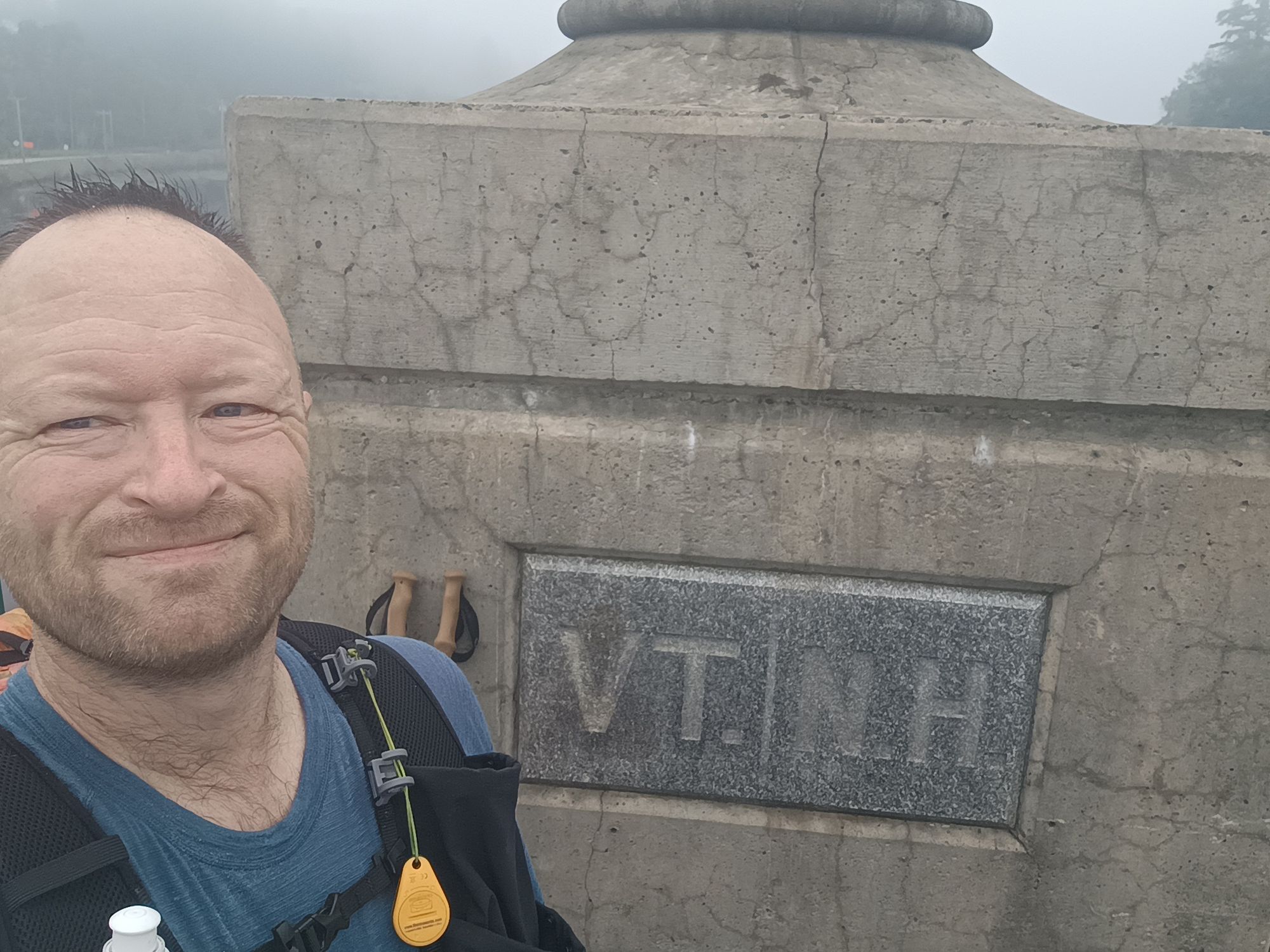
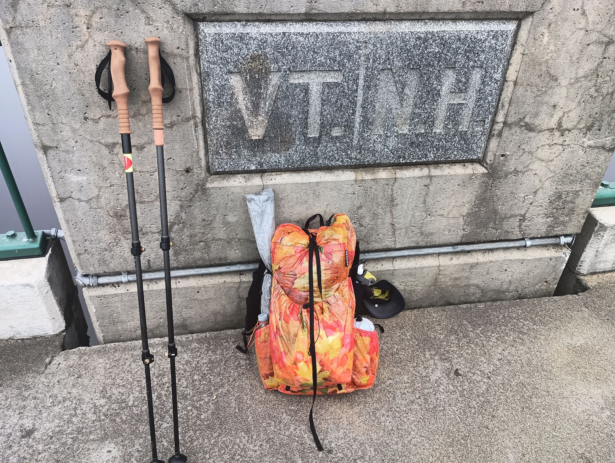
So it was with great anticipation that I started off on day 4 for a long descent into Hanover. I had already determined that there was an Eastern Mountain Sports (EMS) just south of Hanover, and that it opened at 9:00 AM. I was determined to be there when it opened. My objectives: purchase a couple pairs of the Exofficio underwear, and find a synthetic replacement for the Outdoor Vitals shirt.
The downhill march went smoothly. I tried my best to deal with the constant stinging of the chafing, but it was SUPER humid that morning. By the time I approached the Connecticut river there were streaks of sweat, body glide, pus, and dirt streaming down my inner thighs - a truly horrific site. After taking the requisite pictures on the bridge, I marched up the hill to a park across from the Hanover Inn, changed shirts (into my hoodie), cleaned myself up the best I could, and called an Uber.
By 9:05 I was at the door of EMS, where I unfortunately found out that they did not have any Exofficio in stock. They did, however, have a fully-synthetic "Techwick" T-shirt, and it was even on sale! Score! The helpful store employee suggested I try LL Bean which was conveniently located at the other end of the same shopping center, which I then proceeded to. LL Bean did not have a large selection of Exofficio - and they did not have what I really wanted - but they had something close. I bought it and went into the bathroom to immediately change into my new synthetic underwear and synthetic T-shirt. Ahh! Comfort at last! While sitting on the toilet, I did my best to clean off the pus, sweat, and Body Glide mess and cheerfully used my mini scissors to cut the liners out of both pairs of Patagonia shorts I had with me. Walking out of that bathroom I felt semi-normal and much more confident.
I still had to deal with one thing - the wet mop of the Outdoor Vitals T-shirt. I could pack it out in a ziploc bag or I could ditch it. Besides the unpleasant thought of a slowly mildewing shirt in my bag, I was also annoyed at the fragility of that shirt. It had already developed a number of nylon-stocking-style runs. I was so disgusted with this shirt that I dumped it in a trashcan without a second thought. Fully refreshed and dressed, I hit up a Subway sandwich shop before hitching a ride back into Hanover and restarting my hike, back at the trailhead by 11:00 am.
About 2 or 3 that afternoon, as I am bopping down the trail, I get passed by a group of 4. I later catch up to them at a stream crossing where they are taking a break, smoking a bowl, and having a snack. I learn from them that they are AT thru hikers who had taken a "zero" and stayed in Hanover the night before, and had started out of Hanover after lunch. They were power-hiking to make it 17 miles before nightfall. (The shelter they were going to stay at - Trapper John Shelter - was 5-6ish miles past where I was going for the day.) I continued on after filtering and filling my water bottles. I remember hearing one of them categorize the hike they had ahead of them as "righteous" and how it would total over 6,000 vertical feet of climb from Hanover to the top of "Smarts" mountain the next day. They passed me again within an hour: one of them blew past me bare-chested and in long pants, sweat streaming down his whole body. I caught up to them a second time at a second water crossing, after which they blew past me again minutes later. I did not see them again for the rest of that day, but I was amazed at the athletic ability of this crew.
The next morning I passed Trapper John shelter and continued the saw-tooth elevation profile of the day. It was ungodly humid. The sweat and dirt river was flowing down my inner thighs again, but the new synthetic T-shirt was SO much better, and the Exofficio was both preventing additional chafing and allowing the raw areas to scab over so they did not hurt as much. However, a new misery had developed. Going to the bathroom necessitated pulling said underwear down. The underwear had fused with dried pus to form protective scabs that were providing relief. Pulling underwear down to go to the bathroom peeled those scabs off each time. I cringe even writing about it.
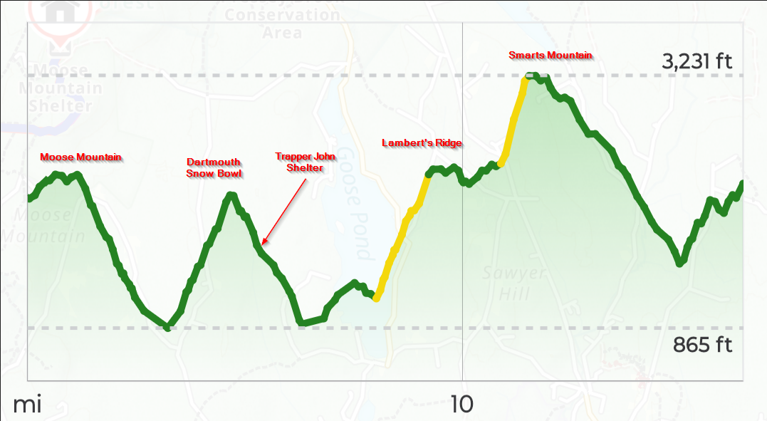
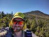
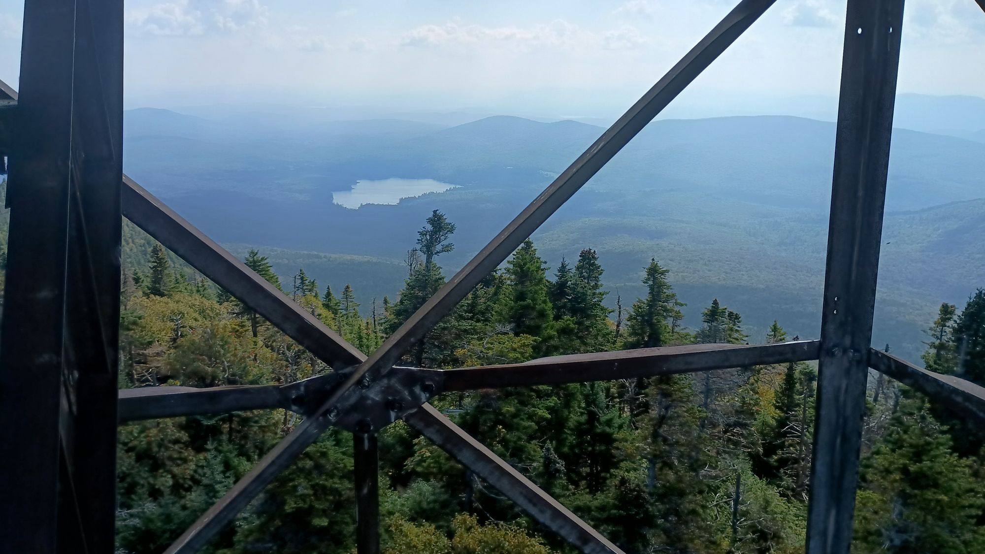
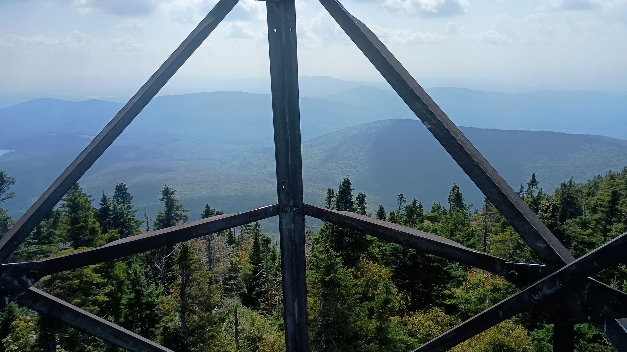
As I trudged up Lambert's Ridge I swore I could smell a whiff of marijuana in the air. Within a few minutes I came across one of the four AT hikers who had passed me the day before. It was the guy who power-hiked bye shirtless. "Checkmate" was his trail name. He was sacked out on the side of the trail, clearly winded. We chatted for a few minutes. I asked about his compadres. He indicated that they were likely miles ahead of him, and that he could not keep up with their pace. He indicated that the speed-hike from the day before had really taken it out of him, and how the heat and humidity was just killing him. Of course I concurred. I commented about him likely passing me shortly to which he just scoffed. I continued up the trail, breaking out onto an escarpment with exposed rocks. I took the opportunity to strip down and lay all my wet clothes out on the rocks to bake in the sun and dry for nearly an hour while I ate my lunch. After a dry-out, I continued up finally making it to the top of Smarts Mountain. I climbed the fire tower but quickly abandoned the glass house on top as it was super stuffy inside. Instead I spent a good 20 minutes sitting on a step right below the top catching as much wind as I could, drinking water, and having a snack.
View from the top of Smarts Mountain fire tower.
I was surprised Checkmate never caught up to me, but pushed on, finally finishing the day at Hexacuba shelter about 6:30 PM. It had been a very long day: 16.4 miles, almost 12 hours of hiking, and 5,171 vertical foot of climb. I was exhausted. There were a couple other folks at the shelter, including an AT hiker who stayed at the same camp I did the night before, who passed me on my way up Smarts Mountain, and who had arrived only an hour or so before me. We all commented about how hot and humid the day was. Then, just as it was getting dark, Checkmate rolled in. He too lamented about the humidity and trail conditions. As I watched, he literally rung the sweat out of his shirt. We chatted for a while where I learned about a hiker hostel a mile short of where I had planned on ending the following day. This place offered showers, laundry, a real bed with clean sheets and a pillow, hot meals, and some basic resupplies for hikers. This was a god-send as I was running short on fuel and had mis-counted meals when Tina and I parted. Checkmate indicated that he was planning on staying there the following night too. Awesome. it was settled. I was going to stay at that hostel!
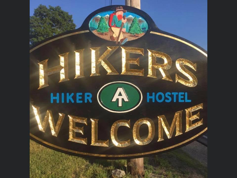
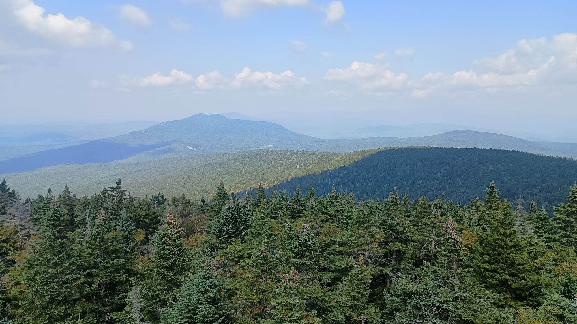
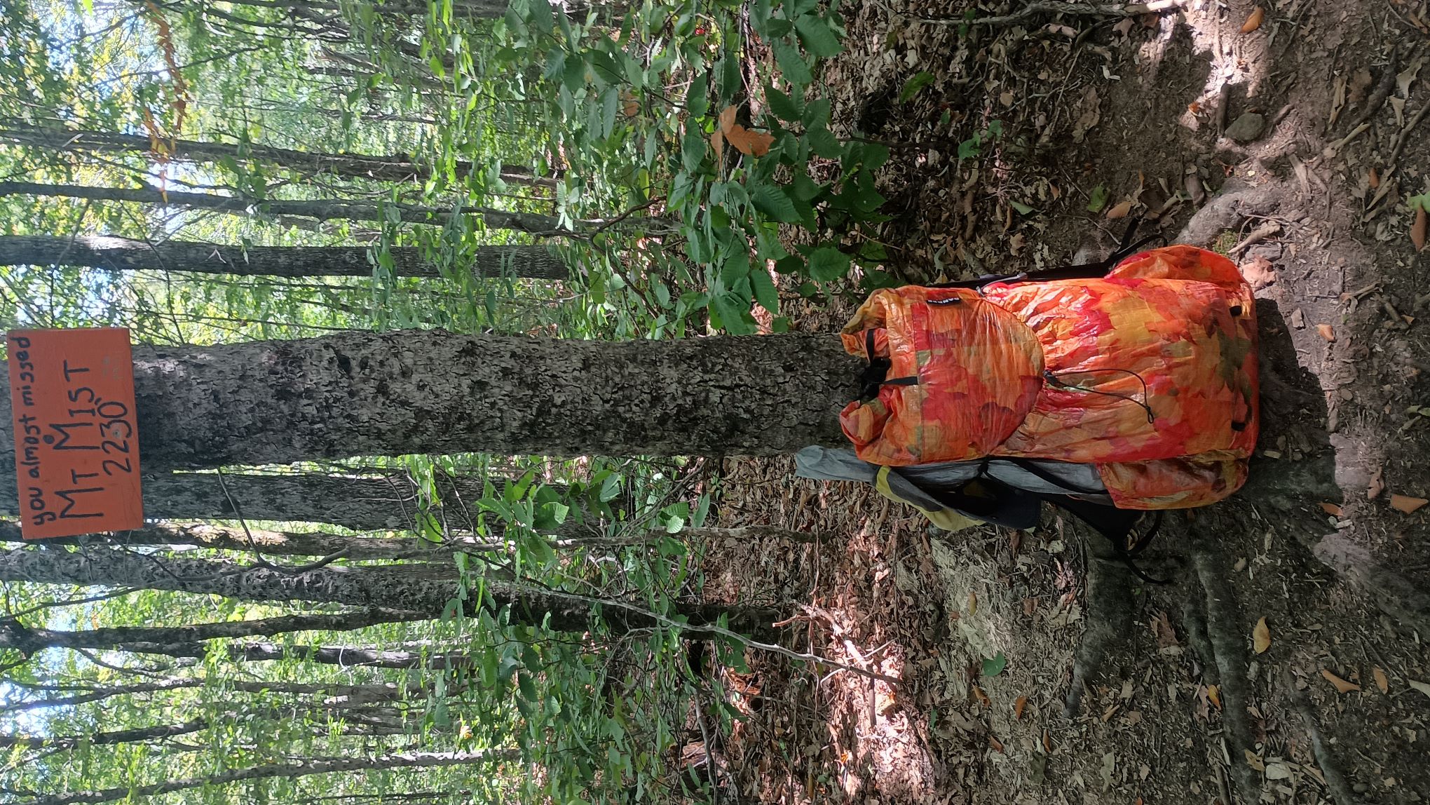
The next day was a rather uneventful day, by the standards of the trip. I climbed Cube Mountain early in the morning where I got some interesting shots of fog in the valley below. I then continued past Ore Hill and Mount Mist, which, as the sign says, you would miss unless someone told you that you were there. I arrived at the Hiker's Welcome hostel about 3:30 that afternoon - a nice relaxing day following the day before.
Checkmate arrived that evening right about dark. He was absolutely soaked with sweat, and equally overjoyed to get a shower, do laundry, and sleep in a real bed. His pants were dark with sweat, and he too had developed chafing. I overheard him talking to his family via phone about how this section of trail, combined with the heat and humidity, was just so much more difficult and how he wasn't able to make any time. He complained how it had taken him 10 hours to go 15 miles.
I timed my hostel stay wonderfully. By doing so I avoided a line of thunderstorms that hit overnight. The bunk room was hot and stuffy when I went to bed, but cooled off significantly once the storms rolled in. For the first time the entire trip, I actually got a bit chilled.
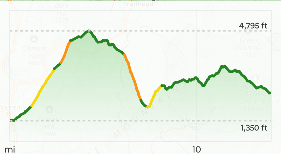
I got a good night sleep, and went to bed well fed. I had splurged on hiker hostel junk food goodies - chips, soda, frozen pizza, ice cream, etc. And the next morning I indulged in not one but two Jimmy Dean sausage breakfast sandwiches. That was a good thing as shit was about to get real. Day 7 involved climbing 3400 feet in roughly 4 miles to reach the south peak of Mount Moosilauke, followed by another 350 feet over the next mile to top out at 4,802 feet. And that was just the beginning.......
The Hardest Day
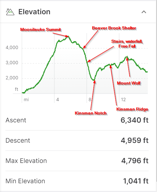
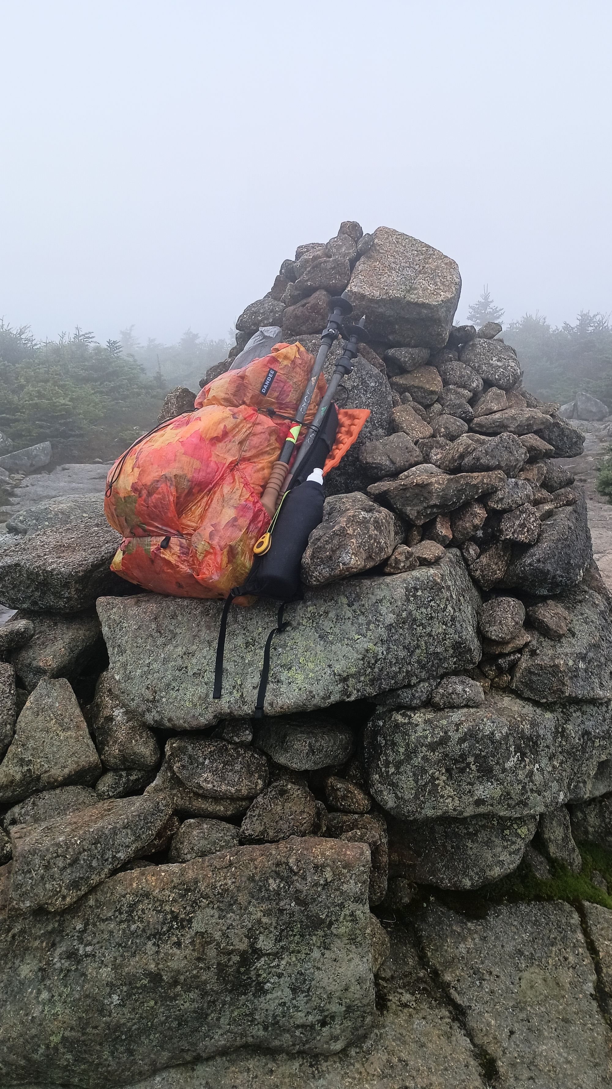
The overnight rain made hiking in the morning quite pleasant. Temps had dropped, and humidity with it. I started hiking just as it was first light - about 6:00 AM. I made it to the top of Moosilauke by 9:45 AM. I was in the clouds - no views to be had.
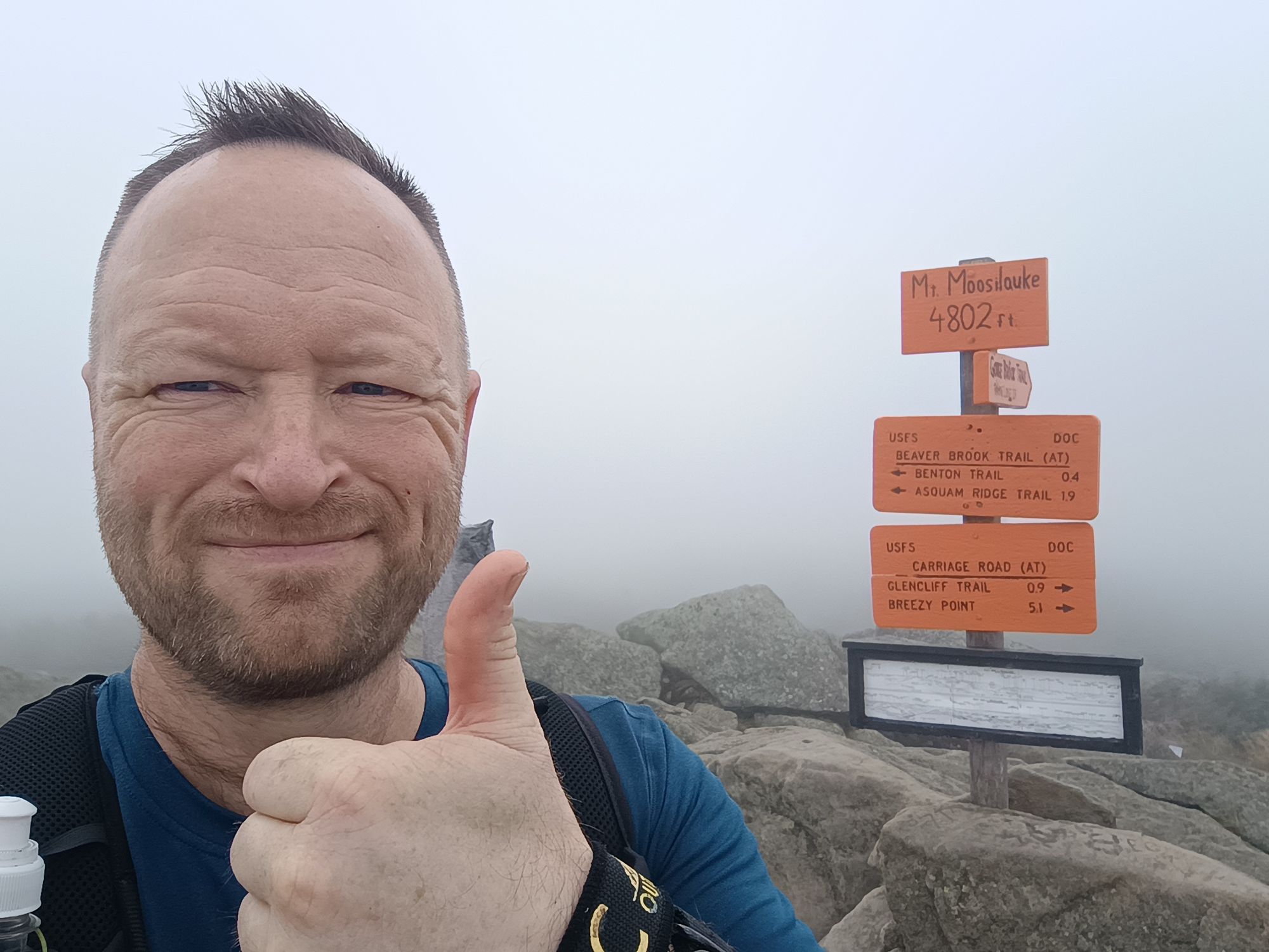
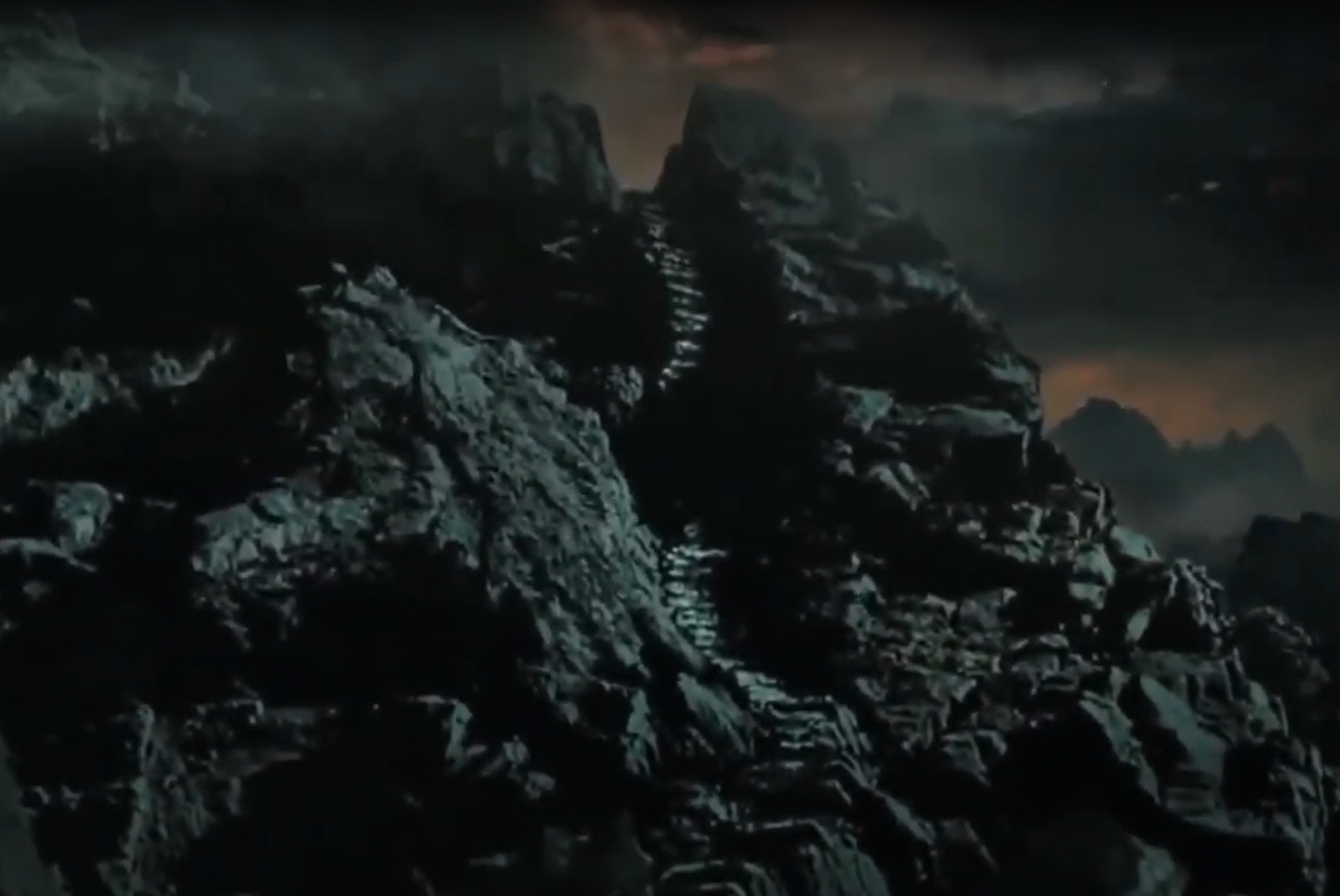
After requisite pictures of the sign to prove I had been there, I proceeded the next 2.25 miles to Beaver Brook shelter to have an early lunch. Lunch was followed by the dreaded decent. If you are not aware of the lore of the north side of Mount Moosilauke, take a few minutes and watch this video
This trail is no-bullshit the steepest thing I have ever done, and the video does a much better job capturing the insanity than I ever could. The homage to the Stairs of Cirinth Ungol from Lord of the Rings Return of the King is not far from the truth.
Stairs of Cirith Ungol
The problem was that I was not going up, I was going down. Images of Samwise Gamgee descending the stairs of Cirith Ungol, only to slip, fall, and land next to the pile of lembas bread ran through my head. By the time I got down to the bottom, I was worn the F out. Never before have I gotten sweaty and exhausted by going DOWNhill. I tried taking some videos of the waterfall to try to capture the steepness of the trail, but just can't do it justice.
Words just don't do this justice
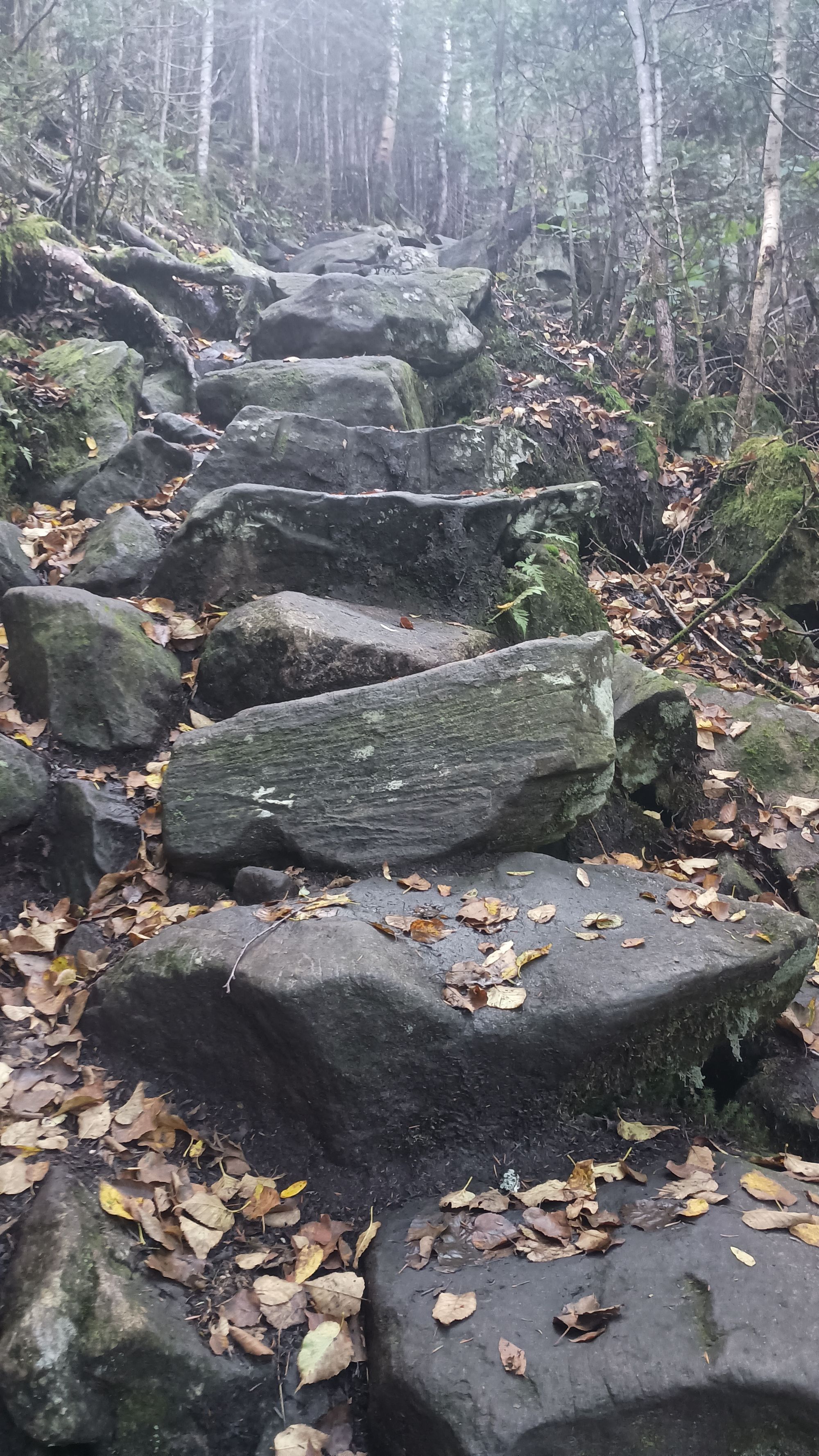
It took me 2 hours to go a mile and a half. This trail was seriously one of the most abusive things I've ever done. Those wooden steps are made out of 8"x8" blocks of wood, and they're probably 16-24" apart. Those are some monster steps. I was carrying a UL pack - which probably only weighed about 10 pounds total at that point - but it was impossible to protect my knees from the insane pounding they took coming down this mountain, even trying as hard as I could.
Needless to say, I was overjoyed to see this bridge at the bottom.
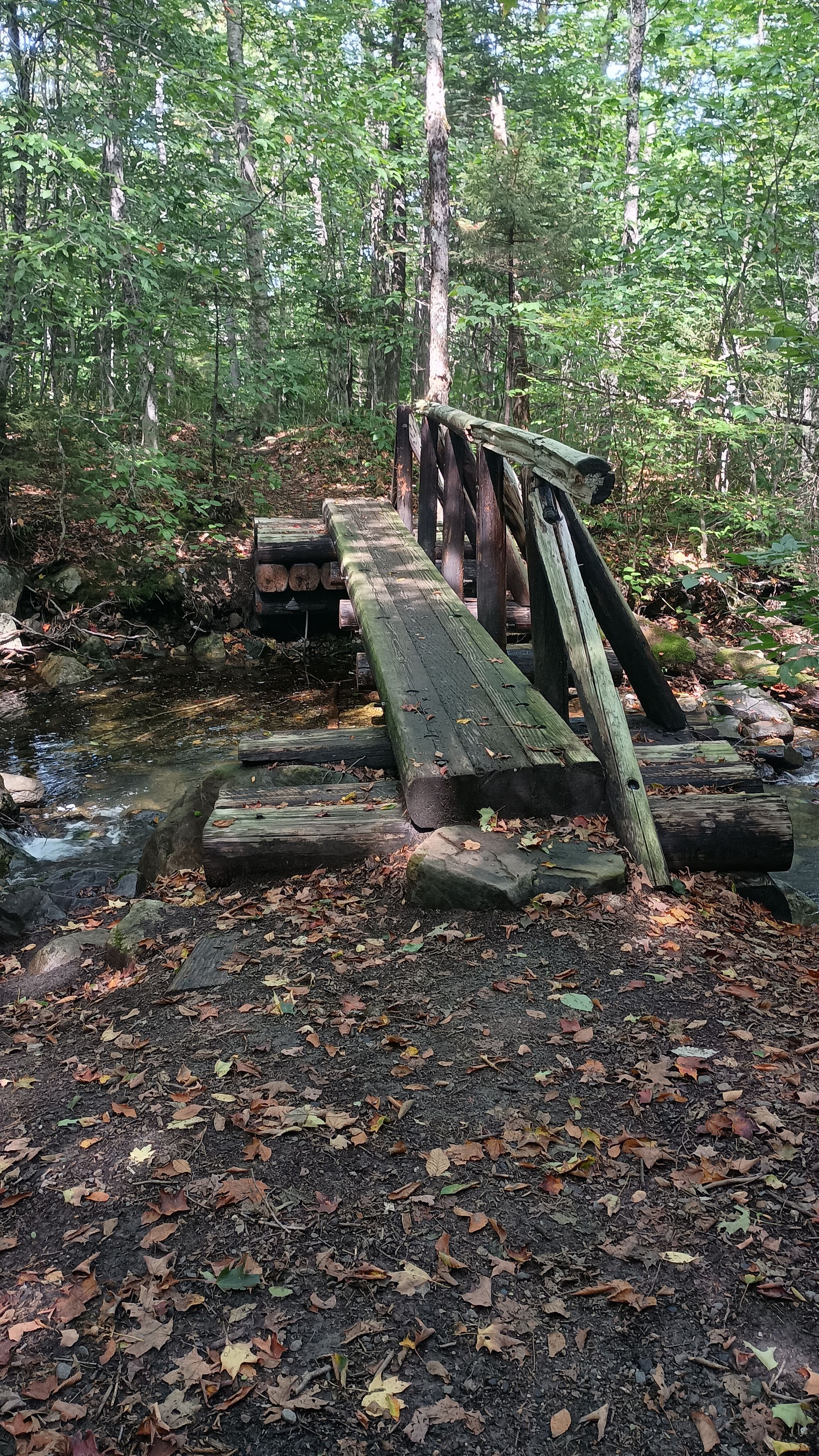
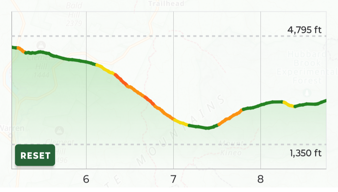
The problem was that this bridge was only 8.7 miles into what would turn out to be a 15.5 mile day. And it was 2:30 in the afternoon. I still had another almost 7 miles, 2,250' of ascent, and 1,700' of decent to go: up Kinsman ridge, over Mount Wolf, and down the other side to make it to Eliza Brook shelter. And My legs were jelly from the beating they just took.
6-7 miles doesn't sound too bad if you could travel 2 miles per hour, but that pace was just unrealistic. There are soooooo many roots, rocks, and obstacles that it was dangerous to move that fast. You've got to work for every step. The day before I took my concentration away for a few brief moments as I dictated/recorded my thoughts into my phone. I did this on a seemingly moderate section of trail. That's all it took. I stepped wrong and twisted the hell out of my left ankle, falling to the ground and hitting hard. SO STUPID!! I knew better than that. There was just nothing smooth and flat about this section of the AT. 1 mile per hour is reasonable and about as fast as you could safely go for much of this.
It was 2:30 PM, I had about 5 hours of sunlight left, and 6-7 miles to go.
When I planned this trip, I planned a number of bailout points. Unfortunately, NH route 112 (Kinsman notch) was the last bail out before final pickup the following day. When I got to about the 11 mile mark (2 miles past Kinsman Notch), I heard the first distant rumble of thunder. I still had about 4.5 miles and the 800 foot climb to the top of Mount Wolf to go. I had two choices at that point: (1) Find a good place to pitch, hunker down, and wait out the storm, or (2) push as hard and as fast as I could to get to Eliza Brook shelter. If I didn't make it to Eliza Brook shelter that night I was worried I would not make my pickup time the following day. To make matters worse, I discovered that I left my headlamp the hiker hostel. I was running out of daylight, did not have a head lamp, had a thunderstorm approaching, and didn't have a good way to contact my ride to reschedule for the following day if I didn't make it to the planned location that night. I pushed on as fast as I could.
I lost the race. The first thunderstorm was just a passing shower. When it passed, so did the dark clouds and it actually brightened up quite a bit. The second thunderstorm was a real soaker. I had opted not to don rain gear as I was already soaked. I just pushed on. The speed with which I was hiking - racing the fading light - was really thrashing my legs.
Remember how I mentioned that the pus in my groin had dried on the synthetic underwear to create pseudo-scabs that stopped/radically reduced the chafing pain? Well, as water poured down my back and into my underwear, all that dried pus dissolved and opened the wounds raw again. Oh Joy. To compound it, the sweat and forced march had started a new site of chafing. In addition to chafing in the groin on each upper thigh I now had the pleasure of chafing on..... my taint.
I rolled into Eliza Brook shelter just before I could no longer see. I was soaked. My knees were throbbing from the day's thrashing. My feet were developing blisters from walking in wet shoes and socks (a new experience on this trip.) And the entirety of my groin on fire from chafing. I was exhausted. I had been walking for 13 hours. It had been 15.5 miles, 6,340' of elevation gain, and almost 5,000' of descent. I had pushed myself to the limit. I had an answer to the question that Scout had asked me at Philmont. This was my hardest day of hiking ever.
Finishing
The last day was "only" 7.7 miles long, with a 2,300' ascent and a 3.200' descent. I would climb the 4,331' South Kinsman Peak, the 4,293 North Kinsman Peak, and get to investigate my first AMC "hut." I had been warned by a hiker staying at Eliza Brook shelter that the climb up South Kinsman had some exceptionally steep sections that would require significant scrambling. He said most AT thru hikers packed their poles away so they could use their hands on the rocks. This was excellent advice. In retrospect, I should have done that coming down off of Moosilauke. It might have lessened the abuse on my legs if I slowly eased myself down on all fours rather than try to lower myself down upright with poles.
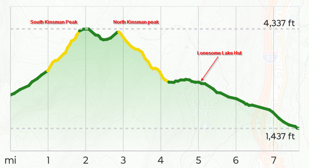
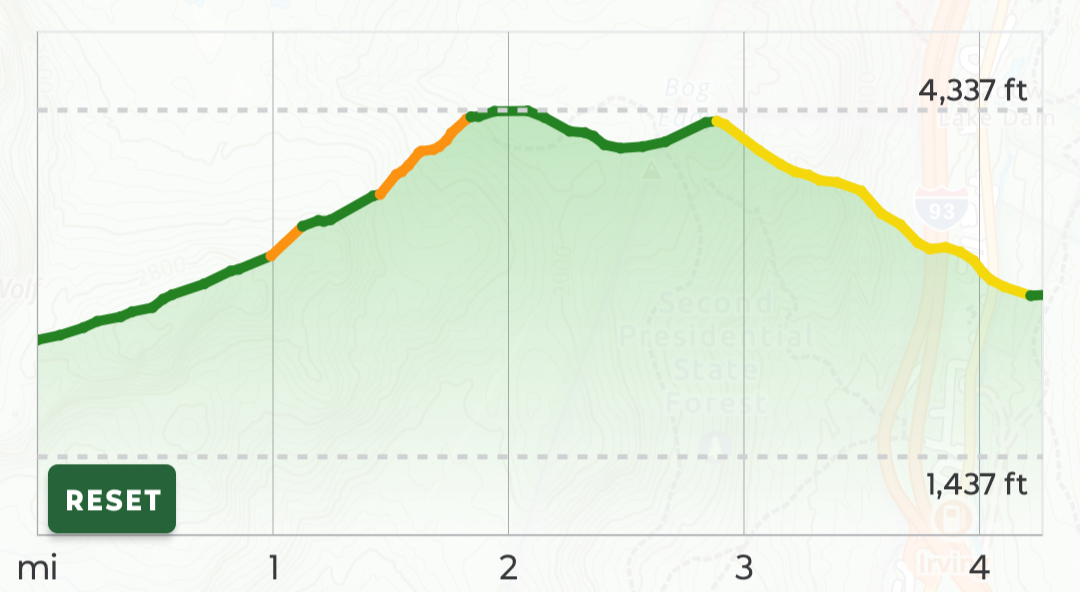
The climb up South Kinsman was challenging. It required some contortion in many locations to maneuver up the steep trail. The summit was, again, in the clouds, but I kind of preferred it this way. I had a bit of nostalgia with alpine spruces in the rain - a situation I had been in so many times in my youth: something special about the smell of mountain spruce in the rain. The temperature was a mere 52 degrees on top. It felt like home. Life was good.
Of course, I had drugged the heck out of myself when I arose that morning, and had given those drugs time to work before I started out hiking: I took max doses of both Alieve and Tylenol, which I followed that up with the last of my Tylenol at lunch.
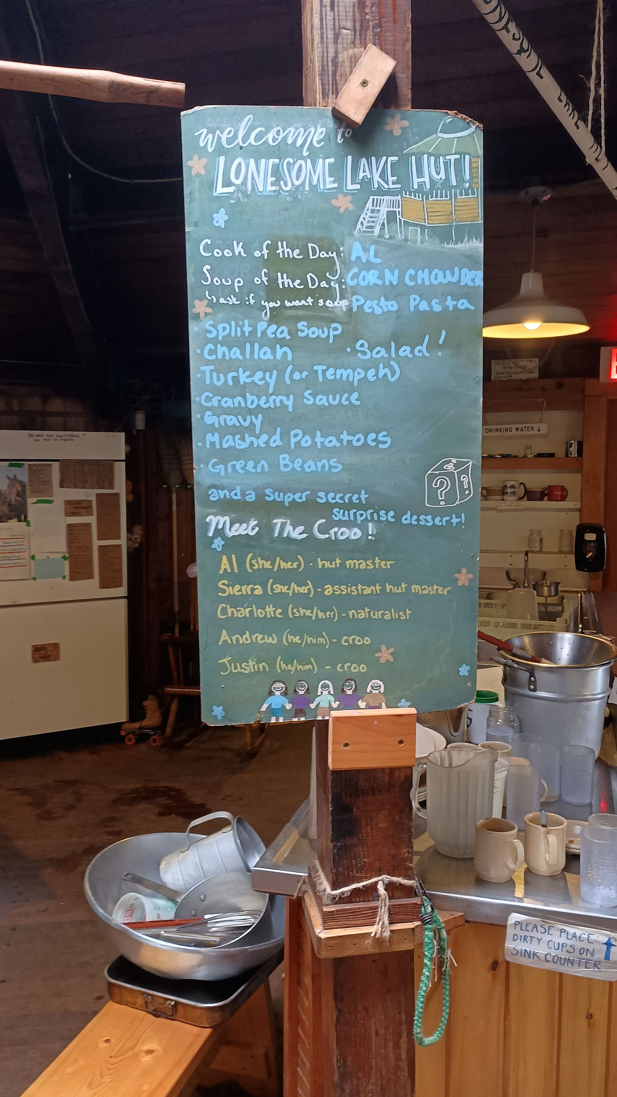
I ate lunch at Lonesome Lake AMC hut. Pretty cool. My next trip to the Whites will have to be planned around staying in these. They're expensive, but posh: real beds, real bedding, breakfast and dinner included. And the smell! They bake fresh goods every day.
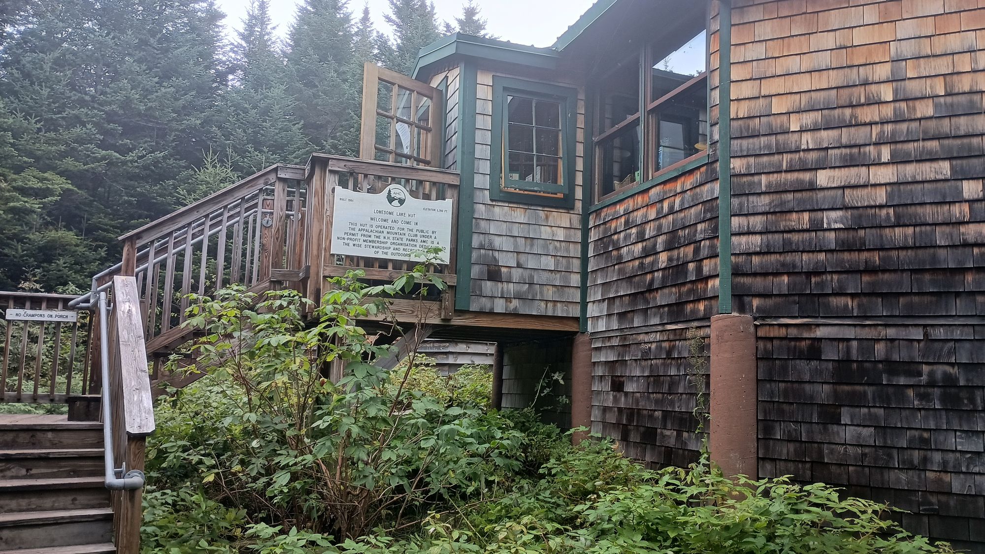
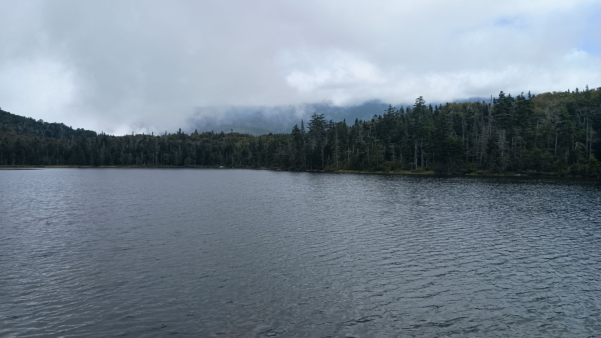
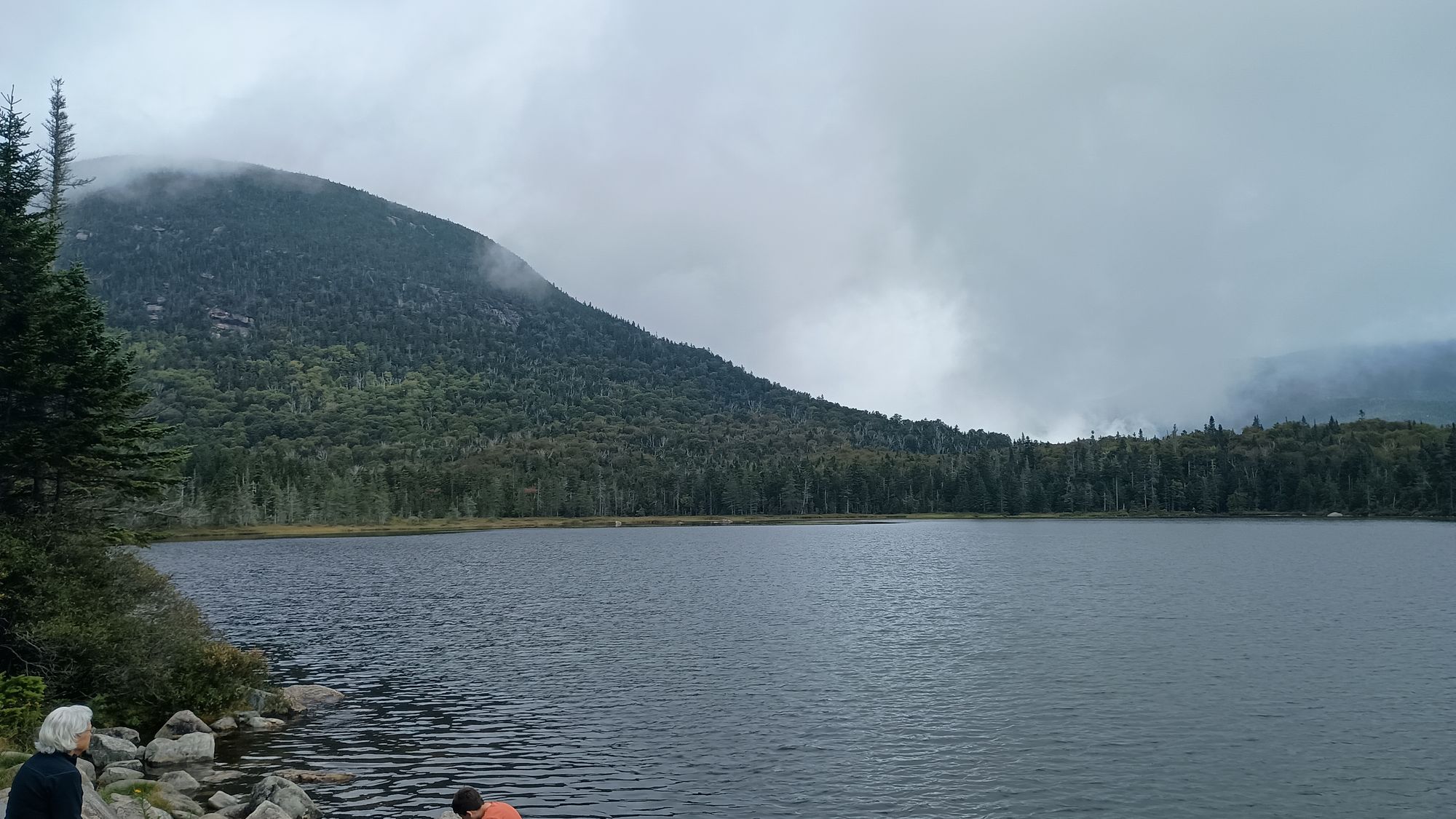
Reaching Lonesome Lake Hut was essentially the end of the trip. There were only a few miles and 1500ish feet of descent to go, but everything below the hut was trivial in comparison to what I had just done. I was able to stroll down the path into Franconia Notch pretty much unimpeded, arriving at my pickup point 30 minutes early. Just like the day before, the two Kinsman summits had completely cleared off by early afternoon.
The car ride back to Vermont was, of course, a story telling session as I recounted the trials of the past week. The real pain didn't set in until later that afternoon/evening as the drugs wore off. I draft this trip report seven days after my fateful encounter with the north side of Mount Moosilauke. The scabs from my chafing are slowly falling away, but my left knee is still quite sore, as is my left ankle. Each day the pain is less. I am hopeful there is no permanent damage. We shall see in the coming days.
Lessons Learned
1) Plan for fewer miles each day. It's not about just the distance or the steepness - it's about the conditions (ruggedness) of the trail. (2) Humidity conditions in the east require different clothes. You don't need to worry about sunburn or sun protection, but you do need to worry about chafing. (3) Even though the Garmin Inreach Mini doesn't do well under tree canopy, bring it next time. It would have provided another communication alternative than just relying on a cell phone. The cell phone service is often no better than tree-blocked satellite, but between the two of them perhaps you'll have a better chance of connecting. (4) Budget a few more calories each day after day 4 of a trip. (5) Plan for extra time for steep descents. (6) Never give up your Exofficio 9" inseam sport mesh boxer briefs. No amount of weight savings is worth it.
Keep Hiking my Friends.